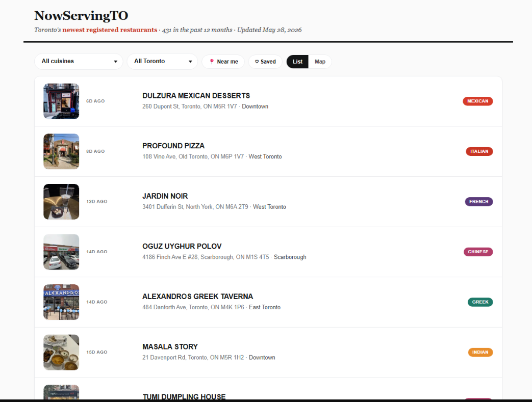
From web apps to visualizations, Toronto’s open data is used to build some incredible tools, services, and projects. We’re lucky to have an engaged and diverse community, and we’re proud to show some of the best examples of where open data has been used to innovate solutions.
Please note: We’re in the process of updating the gallery. During this time you may notice the list of datasets associated with projects are missing links. These will reappear once our updates are complete.
Using Toronto Open Data for something? We want to promote it. Click Here
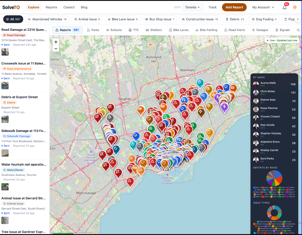
SolveTO is a multi-city civic platform that lets residents report local issues (potholes, broken infrastructure, etc.) and send them to the city, with automatic follow-up tracking until they're resolved (live in Toronto and Mississauga).
What areas (defined by FSAs) for Toronto have experienced a dramatically increase level of demand on which City of Toronto services (defined by City of Toronto divisions as per 311 Toronto Customer Initiated Service Request Data from m2010-2024 inclusive.
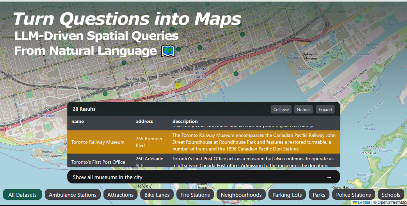
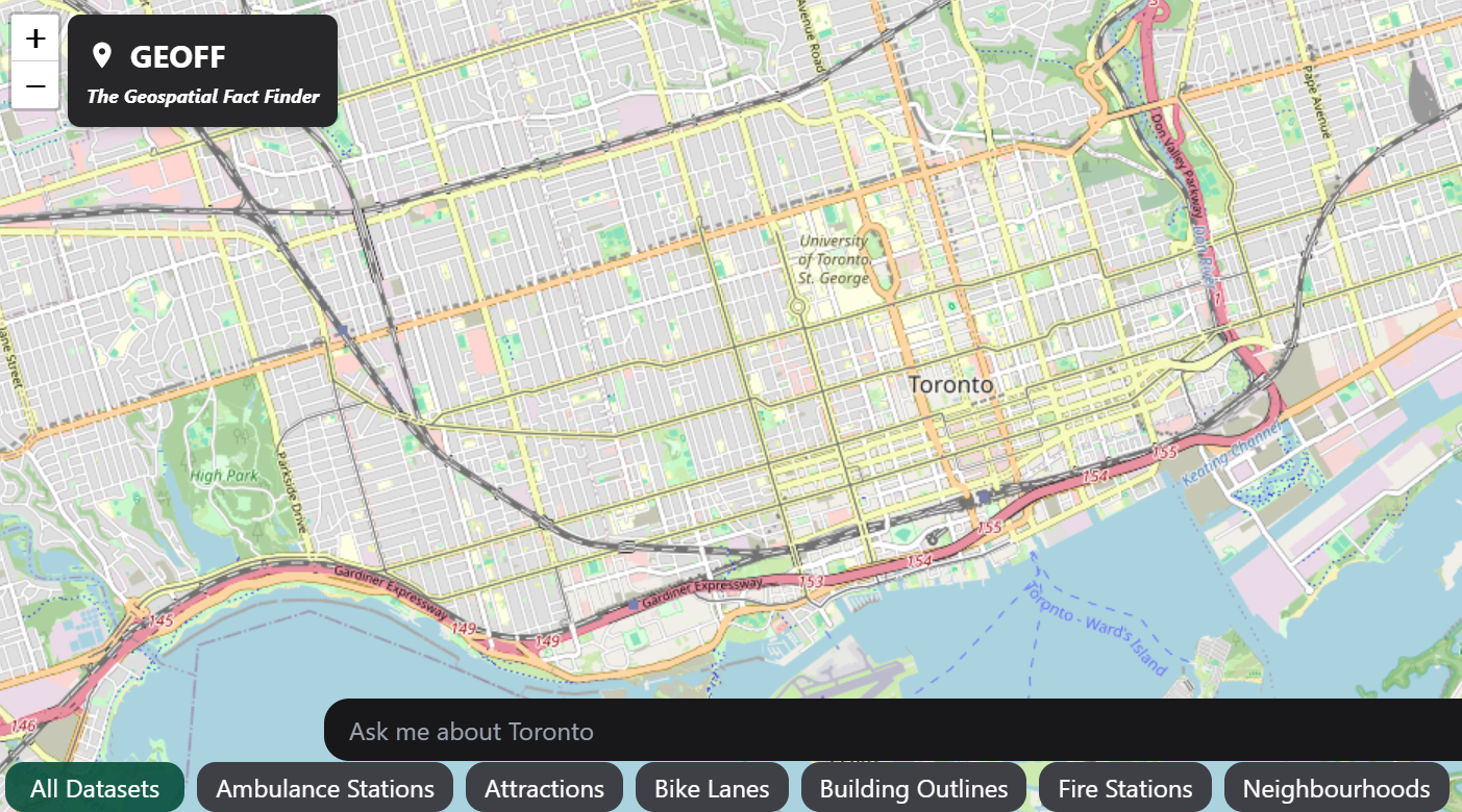
Geoff (Geospatial Fact Finder) - Ask a question, get a map
By Connor Crowe
Geoff is a natural language geospatial query tool that turns questions like “Show all bike lanes added since 2020 within 500m of elementary schools in mixed-use neighborhoods” into live interactive map results using Toronto Open Data.
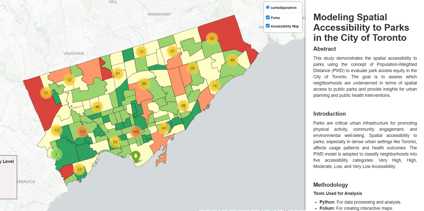
This project uses a population-weighted distance model to move beyond simple park counts, providing a more accurate map of how accessible green spaces truly are to Toronto residents at the neighborhood level.
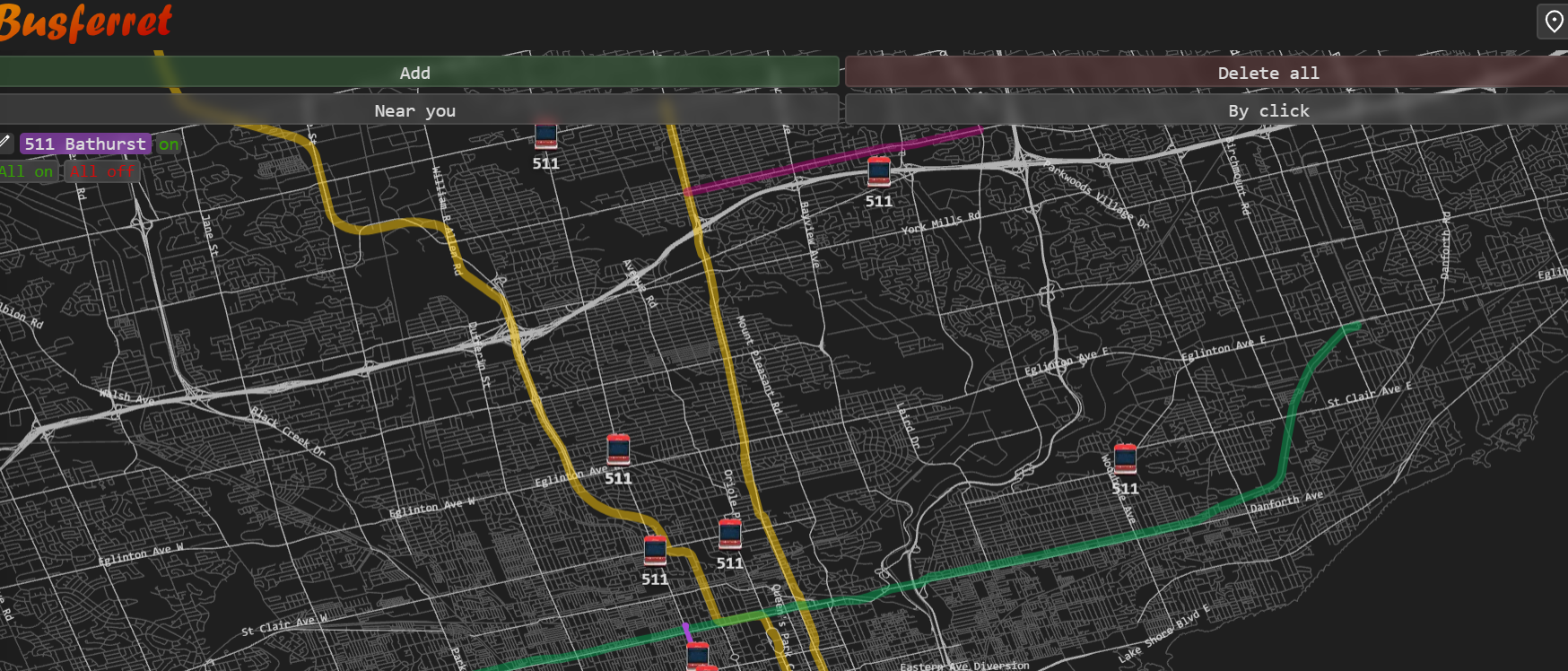
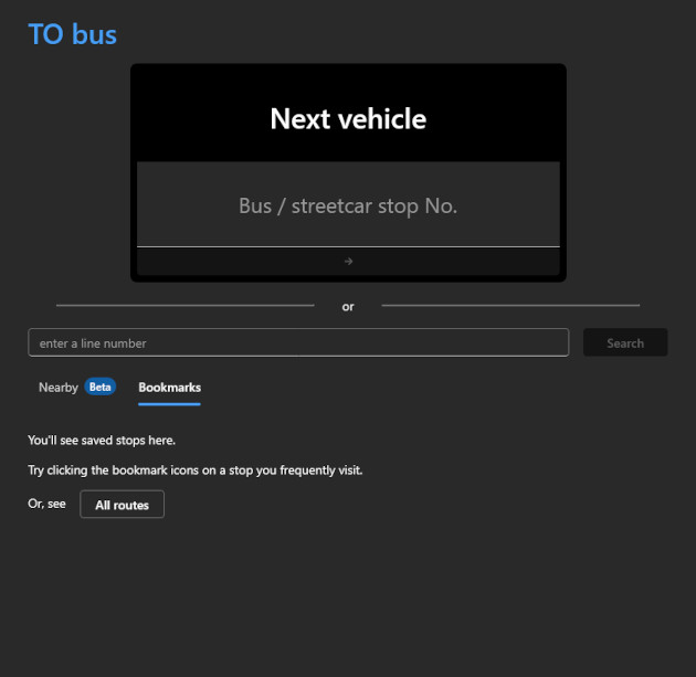
Busferret is a data-efficient, intuitive tracking tool that provides real-time TTC vehicle locations to help commuters with limited mobile data plans navigate inconsistent arrival estimates
SafePassage - The Wildlife Aware Navigation Data Feed
By Andrew Bacchus
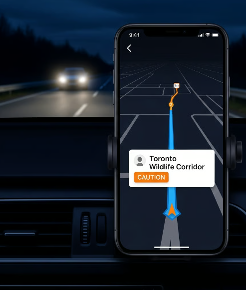
SafePassage converts static 311 wildlife report data into a dynamic API that pushes real-time "High Wildlife Activity" alerts directly to navigation apps like Google Maps and Waze.
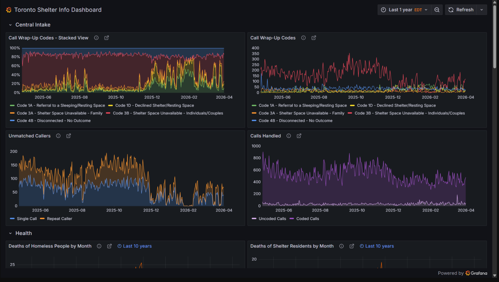
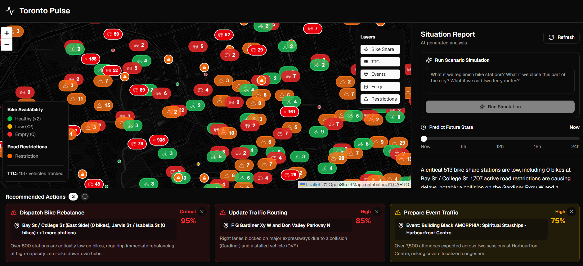
Toronto Pulse presents a model for how open data can help the city evaluate pressure points, understand cross-system impacts, and explore simple planning scenarios.
Canada Spends is a platform to make government spending more transparent. We take raw data and transform it into easy to understand facts for Canadians.
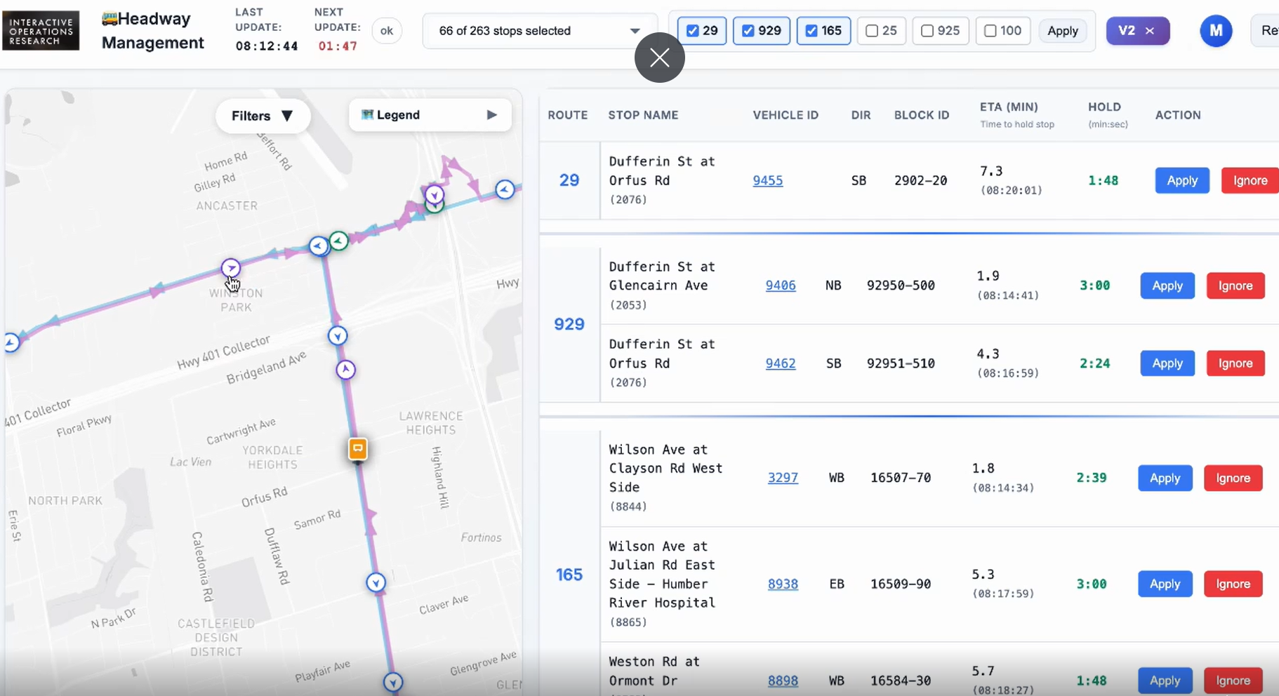
Transit Headway Management Platform for Real-Time Reliability Control
By Interactive-OR Lab
Award Winner
Bus Bunching Correction Pilot: In collaboration with the Toronto Transit Commission (TTC), this headway management pilot on six routes in Toronto to reduce bus bunching (when buses scheduled at even intervals arrive in quick succession) and gapping.
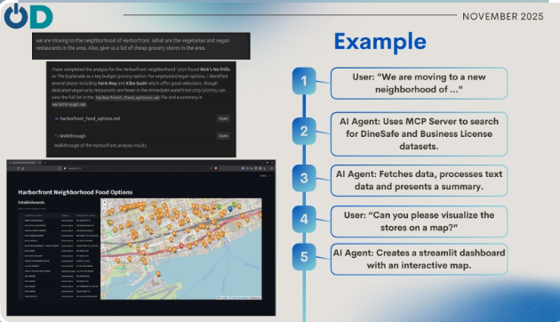
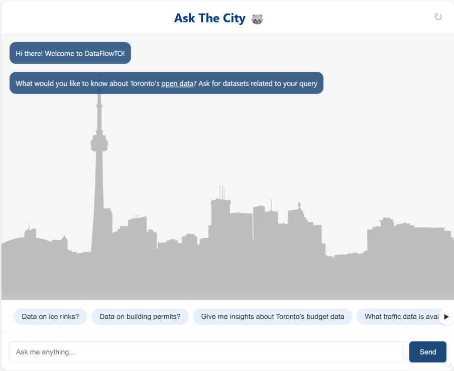
The CKAN MCP Server is a Model Context Protocol (MCP) server designed to bridge the gap between AI agents and Open Data portals, specifically the Toronto Open Data portal. It allows AI assistants to autonomously search, discover, and analyze datasets without m
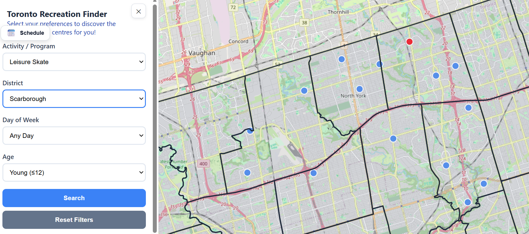
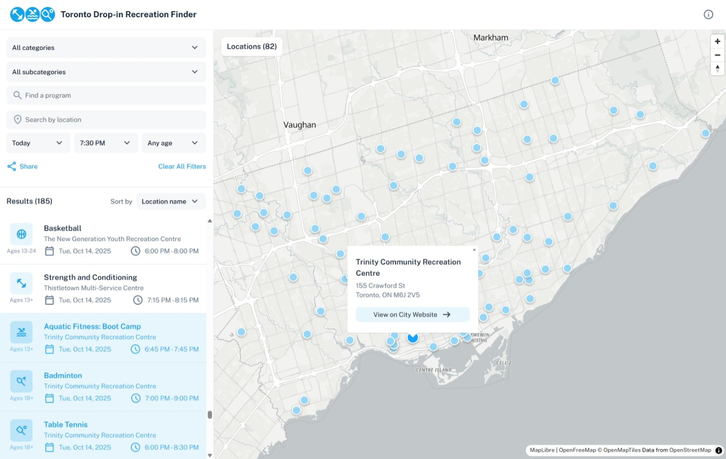
The Toronto Recreation Finder is a map-based interface, allowing users to easily discover recreational activities that match their schedule and location.
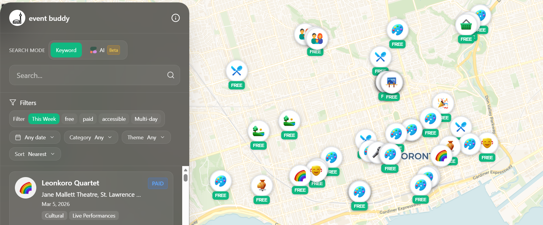
This project transforms Toronto’s open event data into a clean, mobile‑first map that helps people quickly discover relevant events happening now or soon. If you're new to Toronto or on a tight budget, check this thorough app out!
By Yingli Weng, Thanushan Pirapakaran, Bryan Zang, Ammad Qureshi
This project creates a centralized, personalized platform to help Toronto residents easily find free and low‑cost community fitness and wellness programs that match their needs, language, and comfort level.
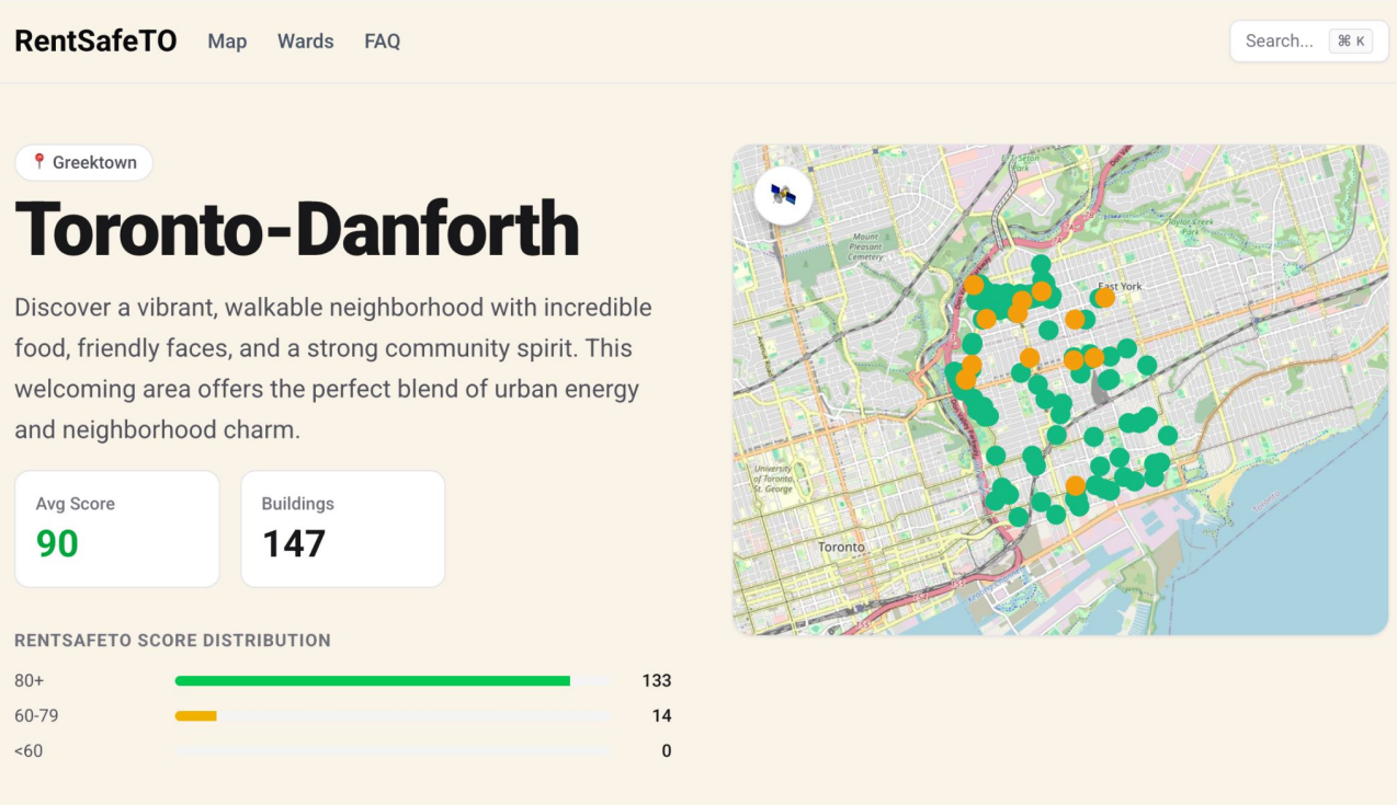
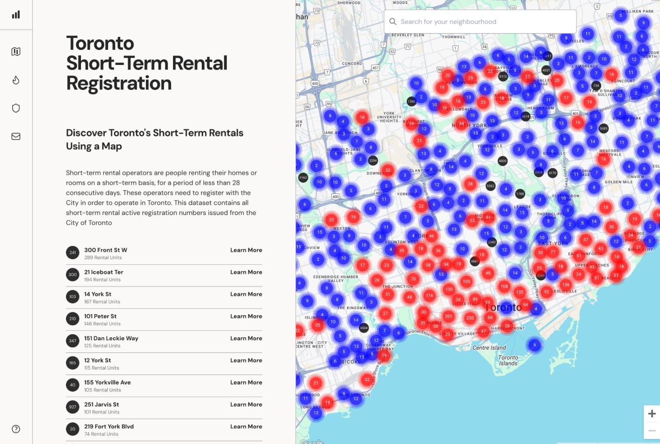
RentSafeTO.com turns the City’s RentSafeTO building evaluation data into a fast, mobile-friendly map so renters can browse, search, and compare apartment buildings by neighbourhood - before booking viewings or signing a lease.
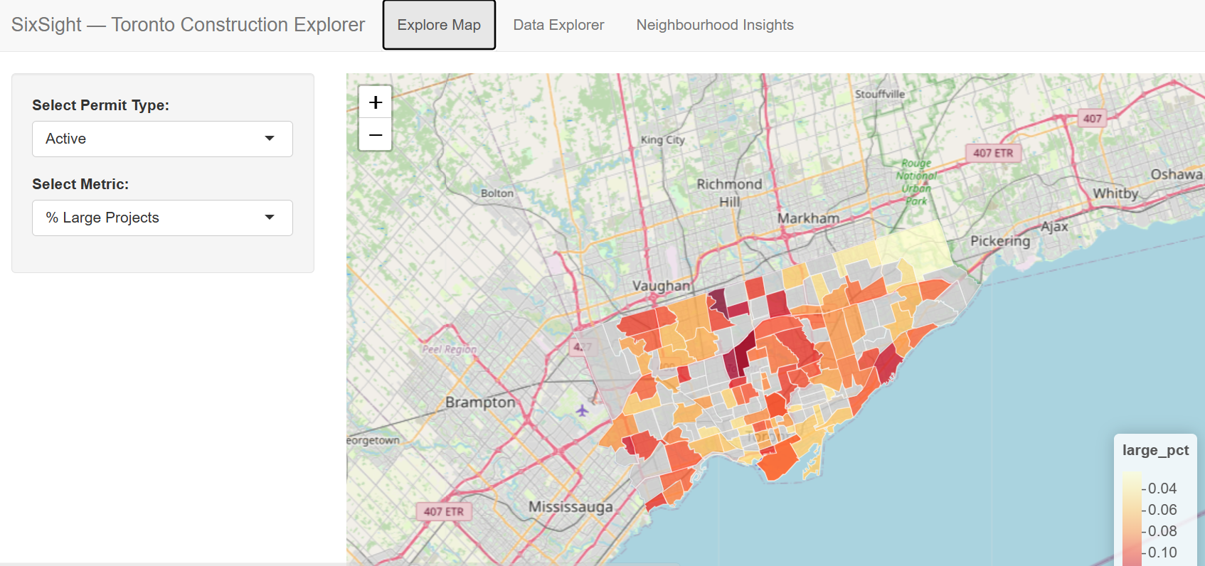
Mapping Urban Construction Activity and Socioeconomic Patterns in Toronto
By Ezekiel Kennedy Bissah
SixSight Toronto Construction Explorer unifies building permits and socio‑economic data into an interactive tool that helps users visualize development patterns and explore how construction intersects with neighbourhood inequality and housing trends.
This project critically examines the 15‑minute city through the lens of healthcare access, assessing how spatial accessibility to essential services shapes wellbeing, equity, and future urban planning decisions.
This project turns TTC delay open data into an interactive dashboard that reveals where, when, and why transit delays happen, helping riders plan trips and enabling evidence‑based transit accountability.
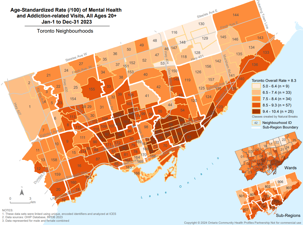
Ontario Community Health Profiles Partnership (OCHPP)
By Ontario Community Health Profiles Partnership (OCHPP)
OCHPP makes high-quality, area-specific, health-related data and maps available for free to everyone. Local level maps shine light on health equity concerns masked at larger areas allowing policy makers to identify + address gaps in access to care.
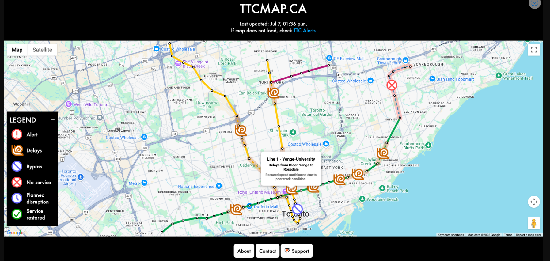
TTCmap.ca is a real-time network status map that visualizes long-term and short-term disruptions in one place, making it easier to see if anything affects your trip.
By Jeff Allen, Remus Herteg, Ahmad Al-Musa - School of Cities, University of Toronto
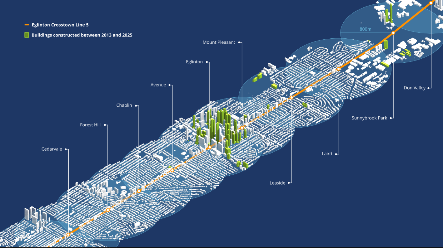
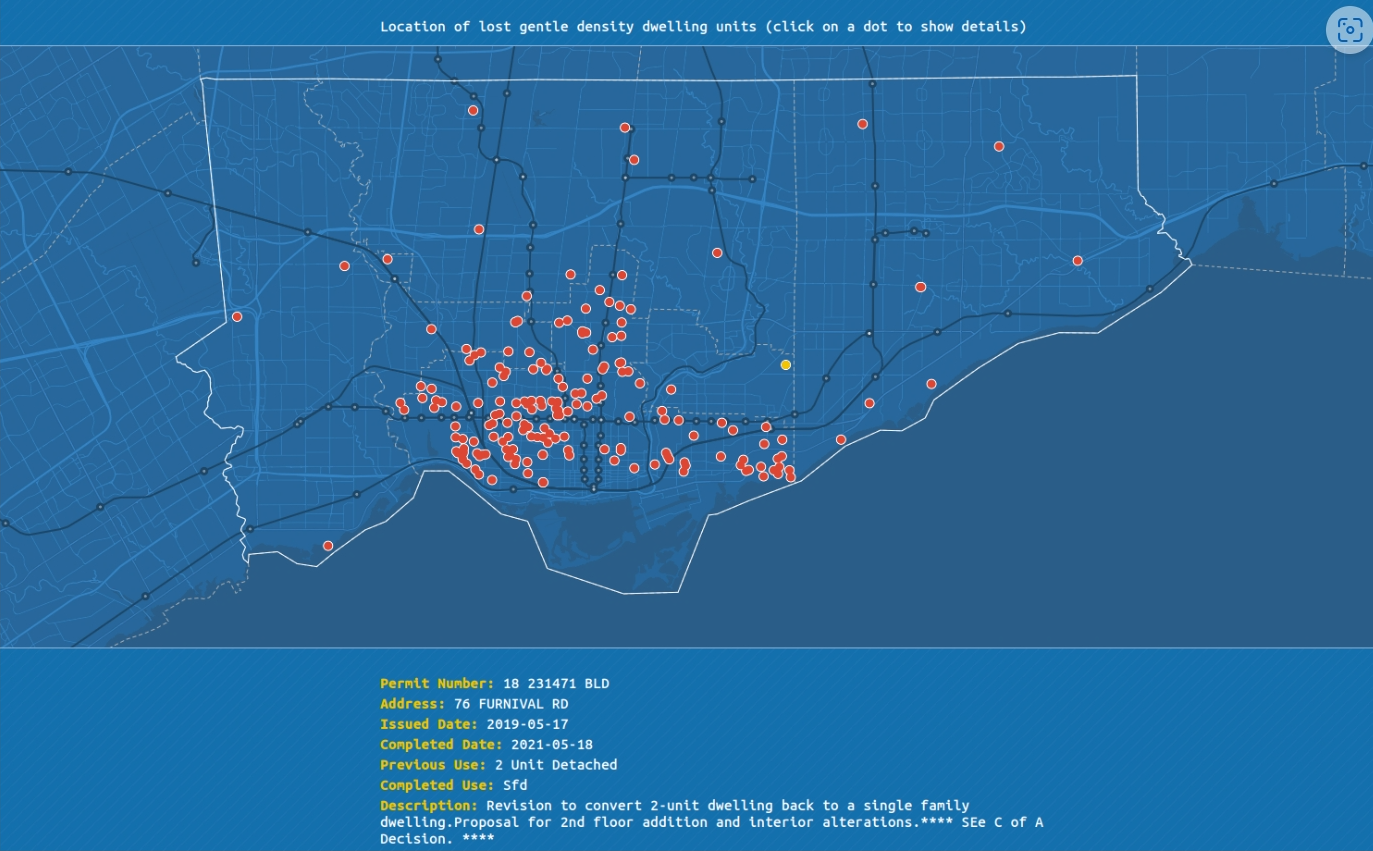
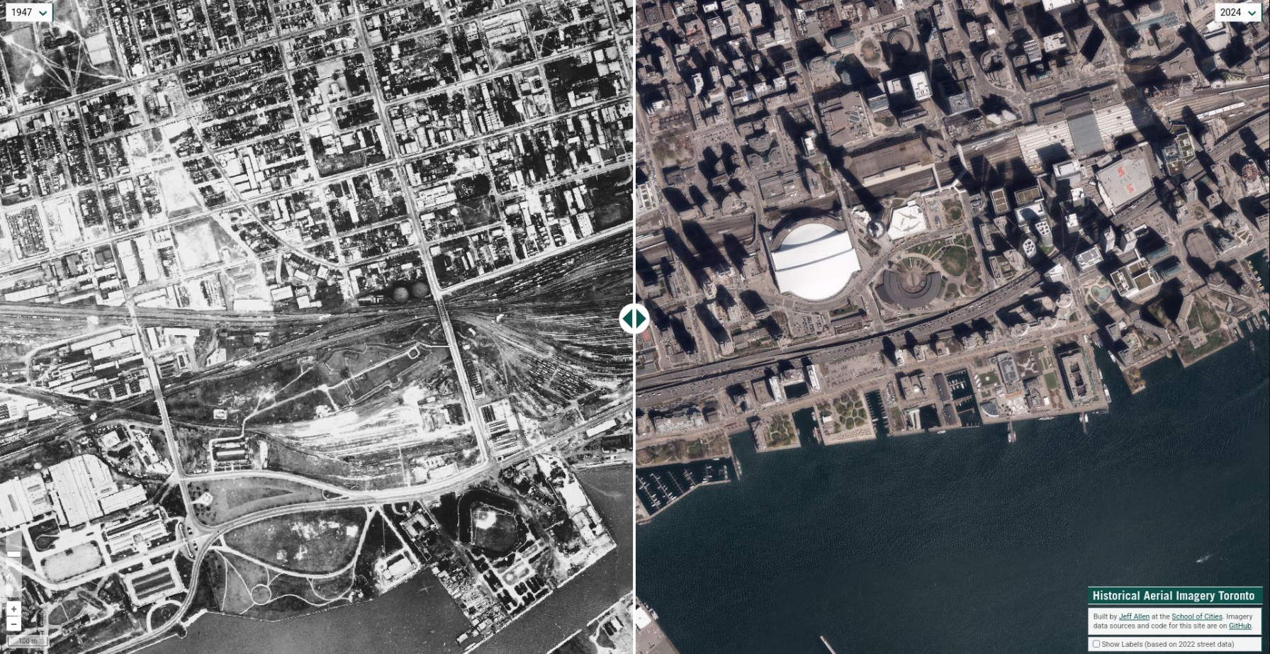
Analyzing how often Toronto is losing dwelling units due to reno-ductions of small multi-family structures such as duplexes and triplexes being converted into single-family homes
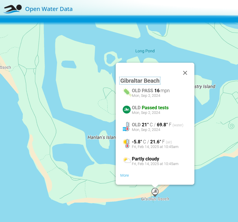
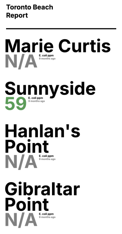
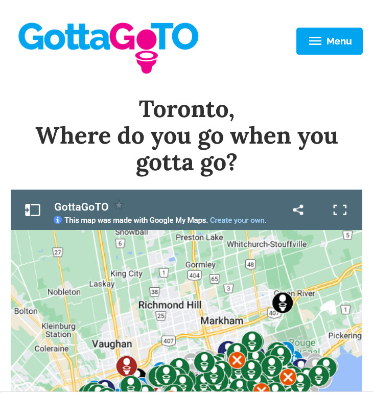
Open Water Data informs open water swimmers and other water recreation users with a wealth of information about popular beaches in Toronto, and around the world so they can make informed decisions about where and when to swim outdoors.
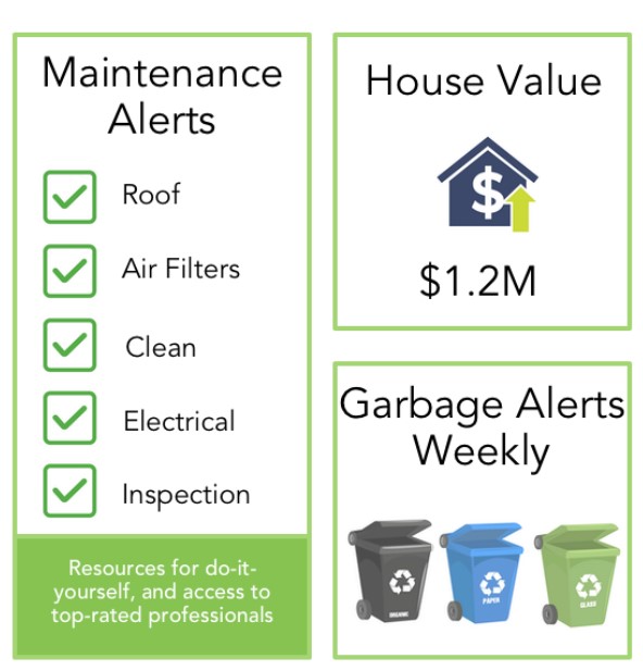
InspectNest is a service that helps homeowners keep track of their home maintenance, garbage collection schedule, and property valuation. It provides timely reminders for home maintenance tasks & keeps track of garbage collection dates.
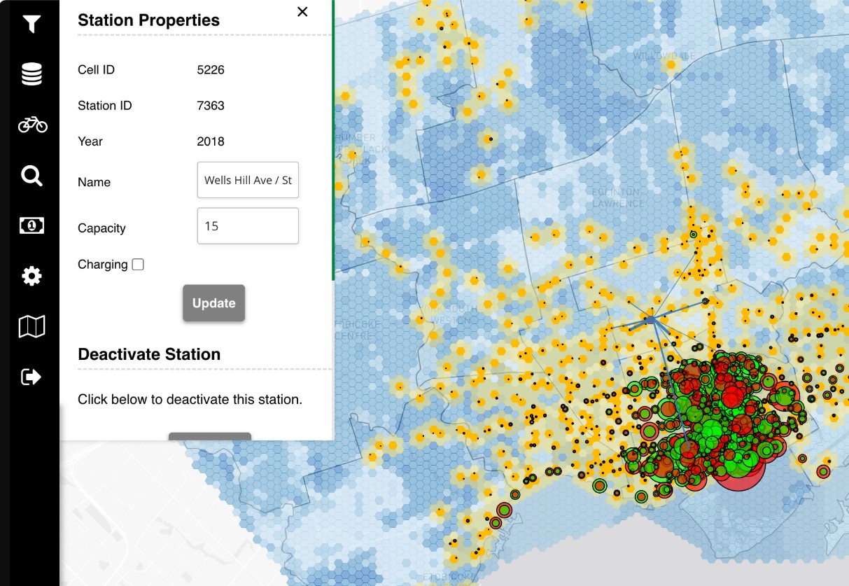
BikesharePro is a web-based tactical planning tool that leverages data-driven descriptive, predictive and prescriptive models to enhance bike-share network expansion, improve accessibility, and support equitable, sustainable mobility planning.
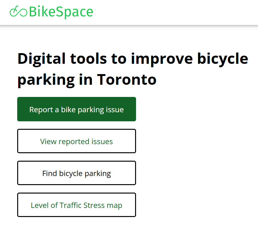
BikeSpace is a free web app run by volunteers from Civic Tech Toronto that allows users to report issues with bicycle parking in Toronto (e.g. broken post and rings, locked abandoned bikes, and areas where bicycle parking is not provided).
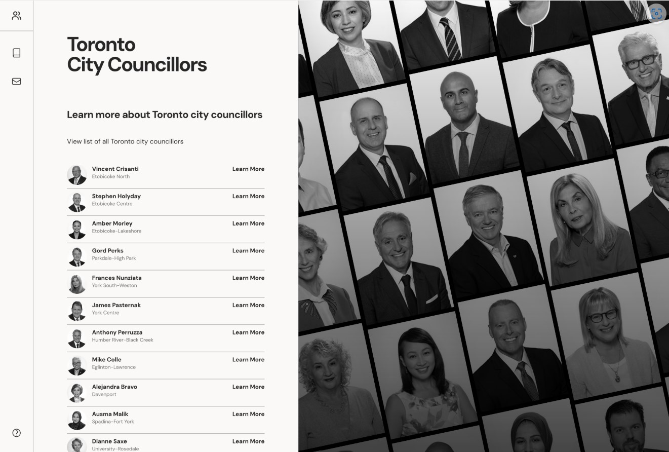
Learn more about Toronto City Councillors! The website is a comprehensive resource for learning about Toronto city councillors, offering detailed profiles that include their voting history, committee memberships, and key initiatives.
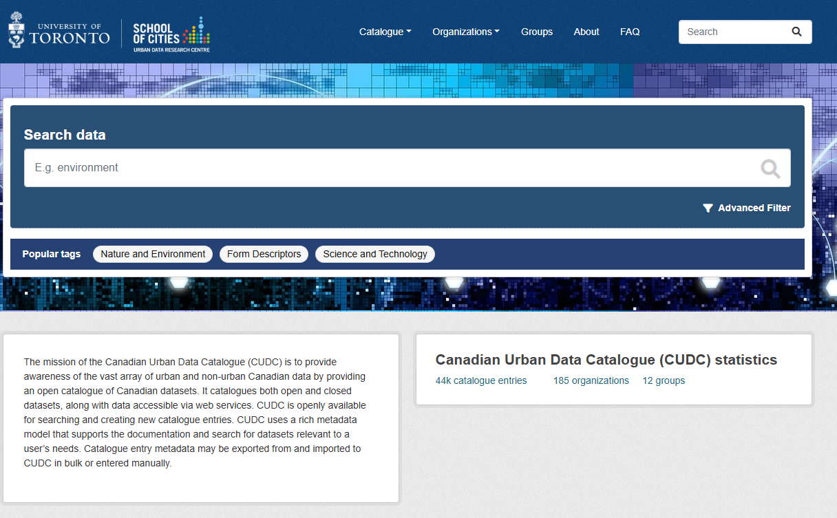
By Urban Data Research Centre, School of Cities, University of Toronto
The mission of the Canadian Urban Data Catalogue (CUDC) is to provide awareness of the vast array of urban and non-urban Canadian data by providing an open catalogue of Canadian datasets. It catalogues both open and closed datasets, along with data accessible
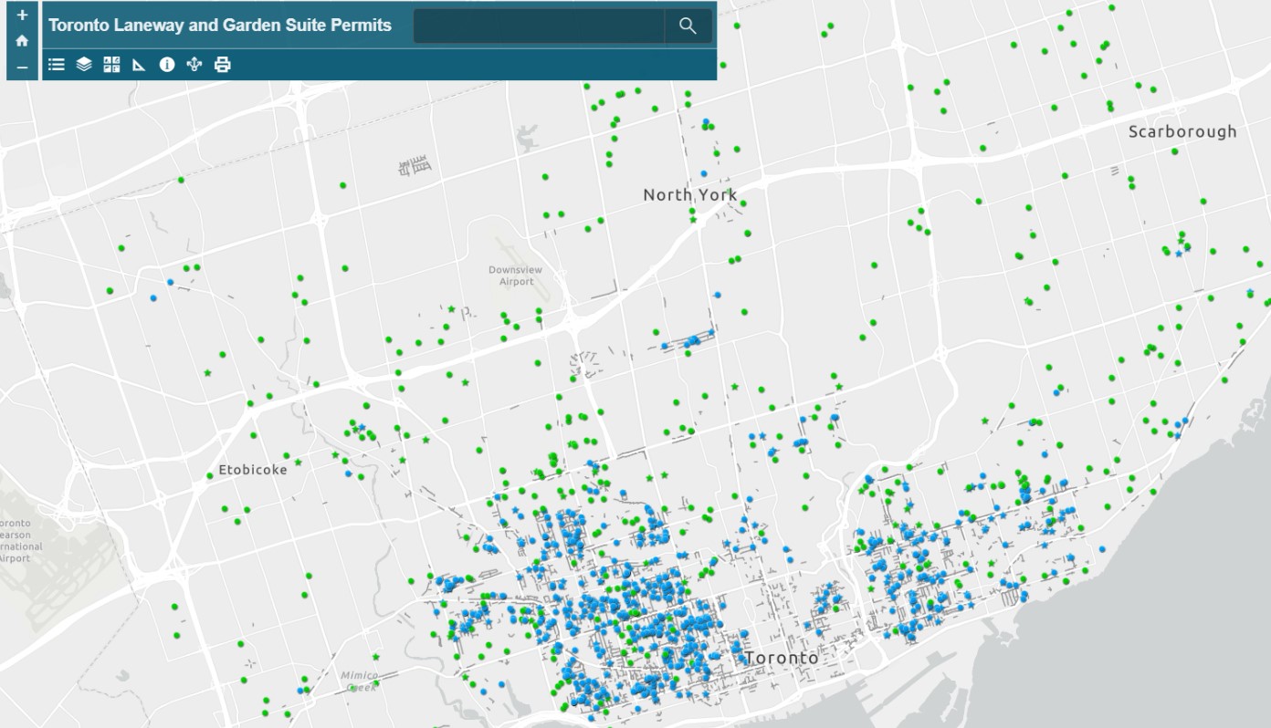
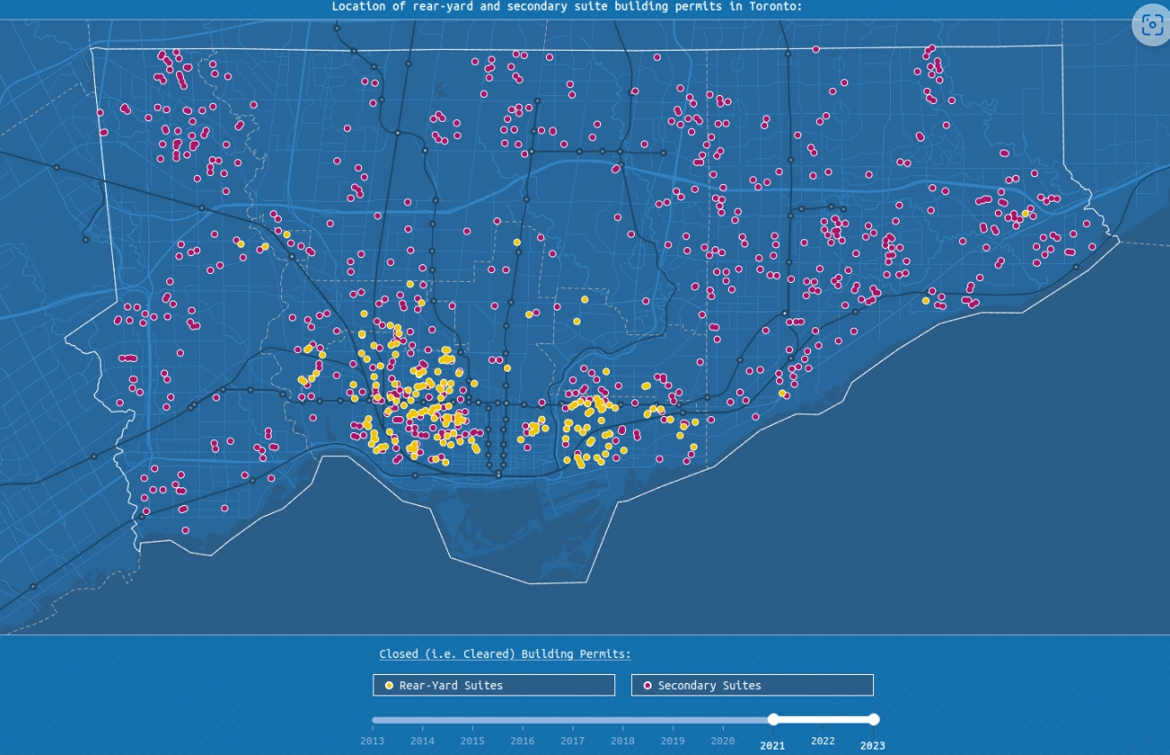
The web map allows anyone to easily view the locations and details for building permit applications to construct laneway and garden suites across the city.
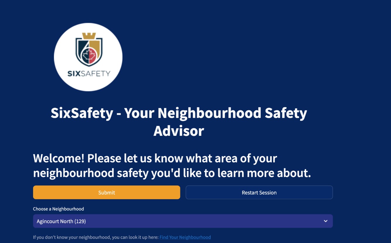
SixSafety- Empowering You and Your Community’s Safety
By Allan Gall Francis, Bailie Geddes, Christine Tang, Ethan Hu, Numan Ekrekli, Zachary Kulik (Team AI Fundamentals)
SixSafety is an AI-powered web application that leverages Toronto's Major Crime Indicator dataset and Large Language Models to generate personalized safety plans for the general public.
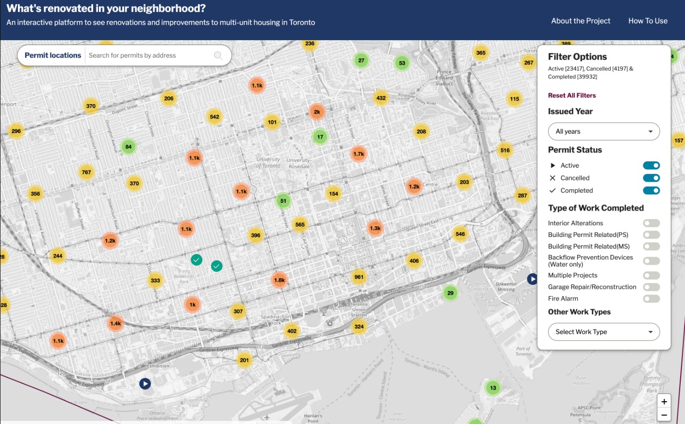
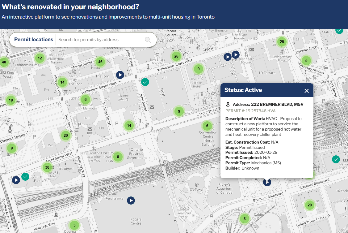
RenovationWatch.ca empowers Toronto renters by transforming complex city building permit data into an accessible, interactive tool to monitor renovations, challenge unjust increases, and advocate against renovictions.
This dashboard offers a quick overview of food establishment inspection results across Toronto, comparing today's 'Conditional Pass' and 'Closed' statuses with yesterday's counts, and also lists establishments that currently hold these statuses.
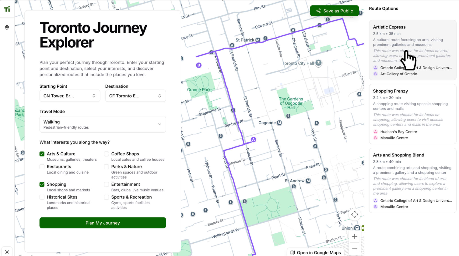
Plan your perfect journey through Toronto. Enter your starting point and destination, select your interests, and discover personalized routes that include the places you love.
ALFRED is an AI-powered conversational assistant that analyzes Toronto Police crime data to provide neighbourhood-level safety insights in the voice of Alfred Pennyworth. It integrates Google Maps geocoding, geospatial crime analytics, and GPT-based reasoning
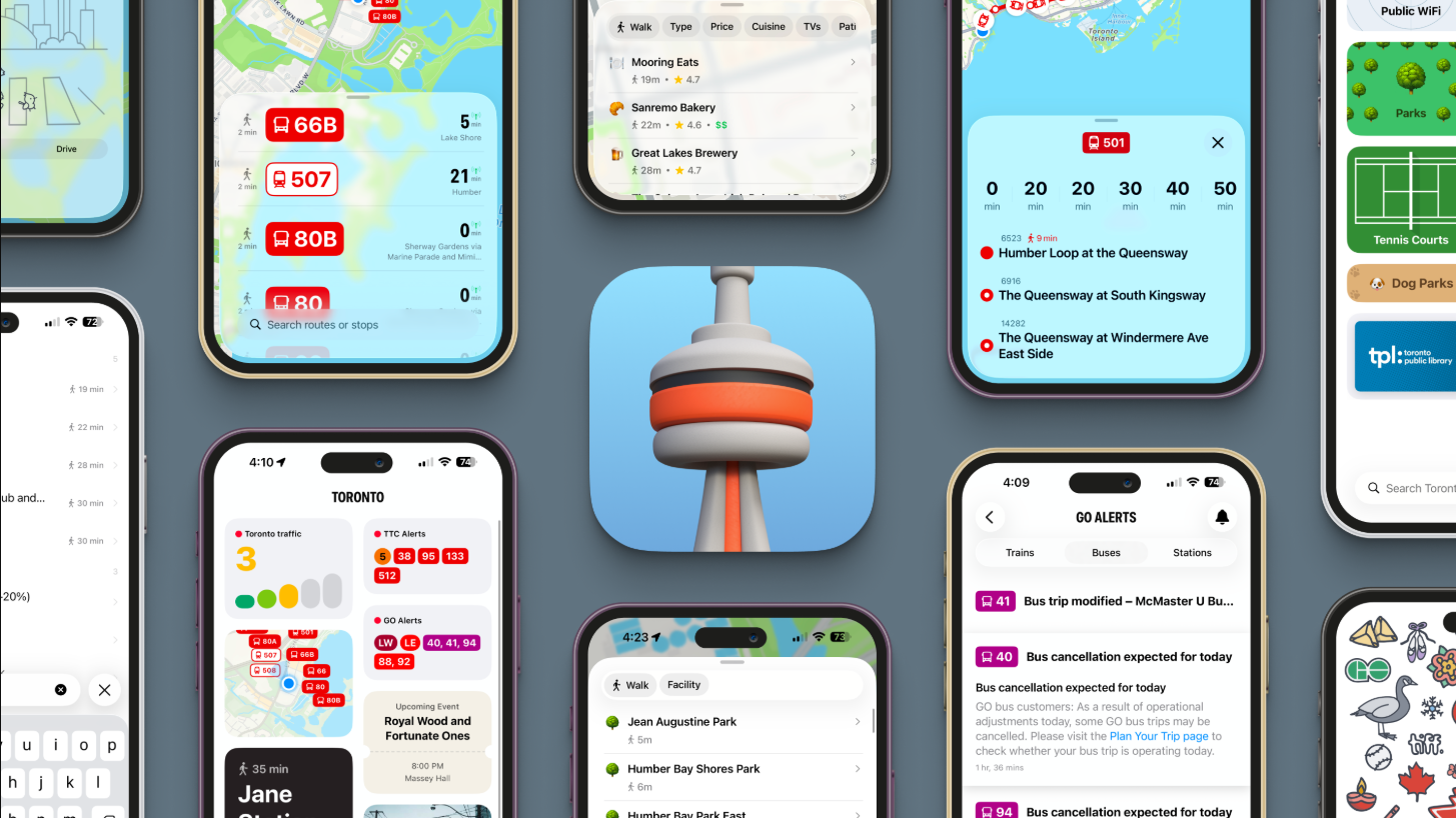
Toronto: Transit & Amenities brings real-time TTC and GO Transit alerts together with a live map of the city's washrooms, parks, libraries, dog parks, skating rinks, and Wi-Fi hotspots in one app.
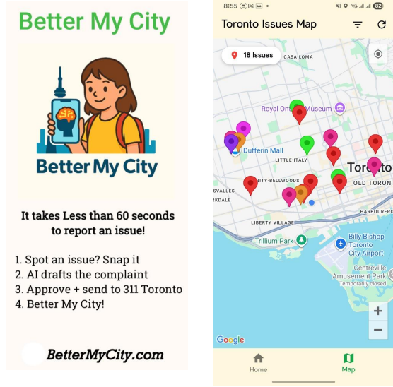
Solution Better My City is a youth-built reporting app that uses AI and mobile photography to help students easily report public infrastructure issues, and receive guidance on additional ways to get problems resolved.
The app aims to serve a broad and diverse population by providing simple, mobile-first access to City of Toronto health inspection data, especially in moments when decisions about where to eat are being made.
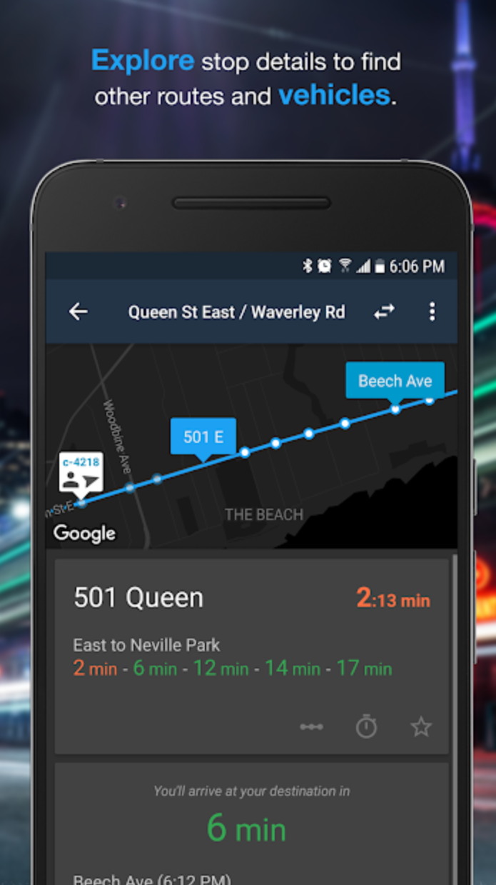
Transit is your real-time urban travel companion. Navigate your city's public transit system with accurate real-time predictions, simple trip planning, step-by-step navigation, service disruption notifications, and departure and stop reminders.
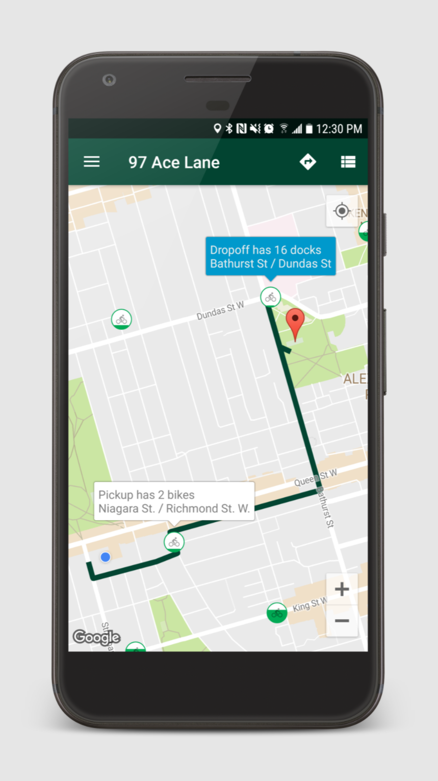
Cycle Now is a free and easy to use app dedicated to improving your bike share experience. Key features include finding the nearest bike or dock (parking station) instantly, alerts if your station becomes full so you can re-route sooner, and a trip planner.
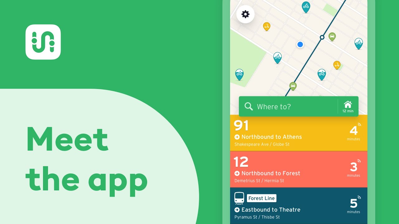
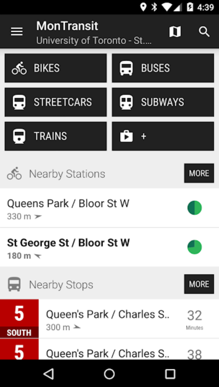
MonTransit effortlessly brings the most relevant transit information to you, including buses, ferries, subways, streetcars & trains schedules (offline & real-time), bike stations availability, service alerts & the latest news from agencies web sites.
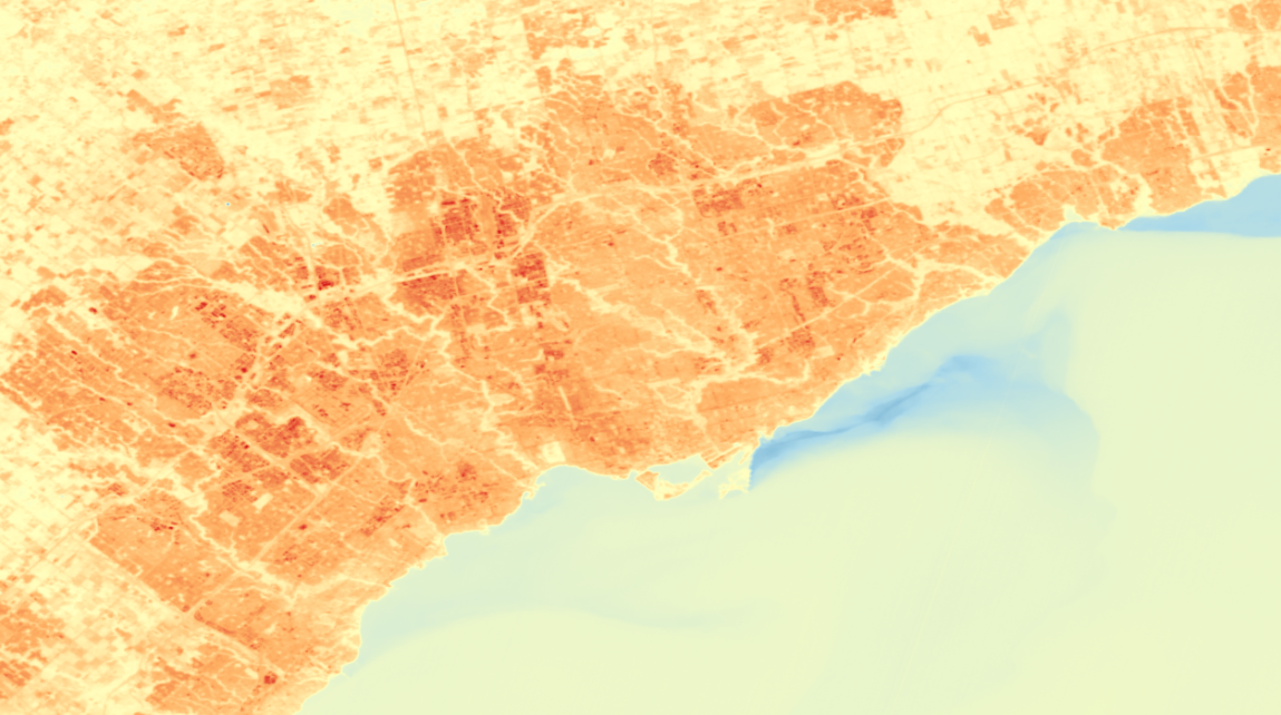
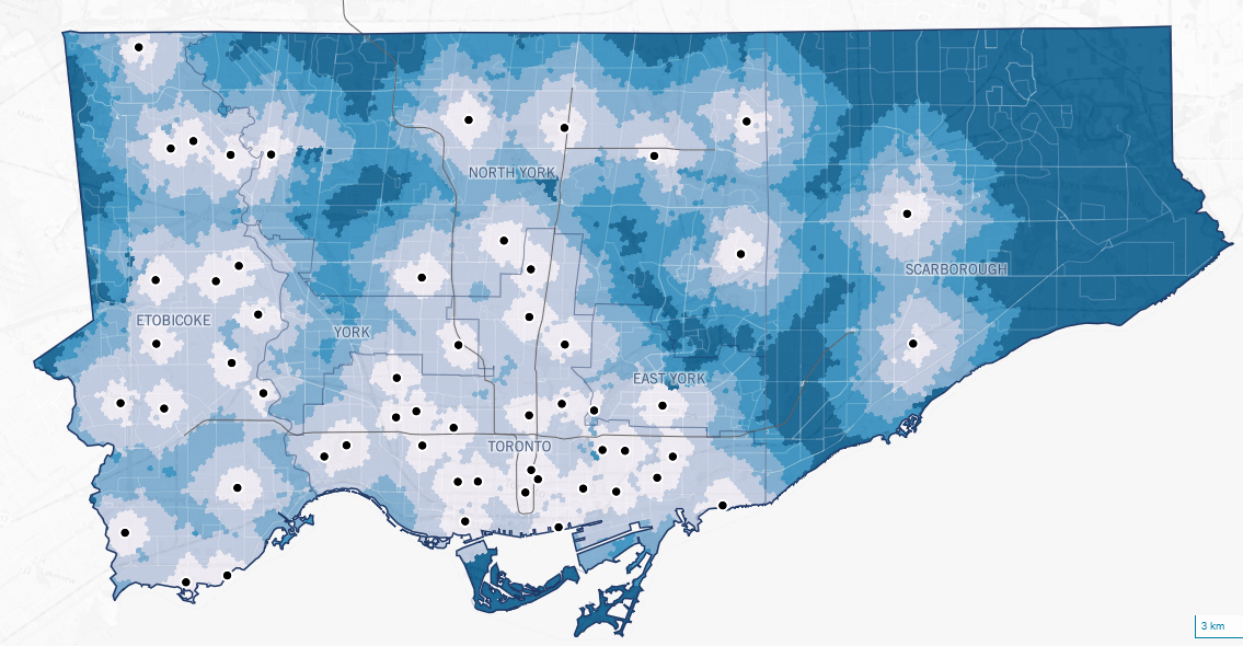
Urban Heat Islands (UHIs) can cause your local temperature to be much higher than reported - where is this effect worst in Toronto, and who does it affect the most?
By Jeff Allen, School of Cities, University of Toronto
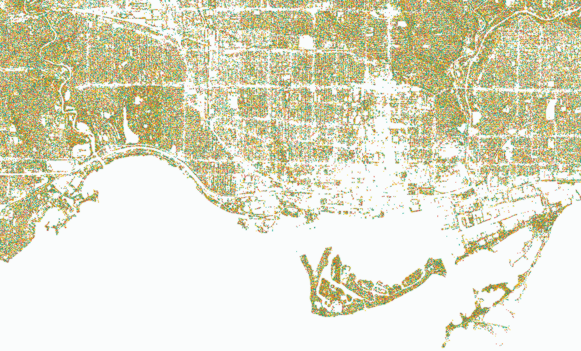
A data-dense visualization of all the trees in Toronto to allow people to easily view and compare spatial distribution of tree cover across different scales
By Jeff Allen, School of Cities, University of Toronto
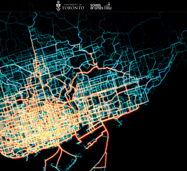
A map visualizing all Bike Share trips in June of 2024 to highlight where people cycle across the city. Project goals were initially descriptive and exploratory, but the map has since been used to advocate for more (not less) cycling infrastructure in Toronto
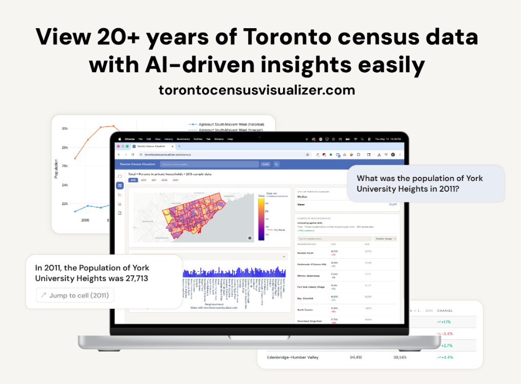
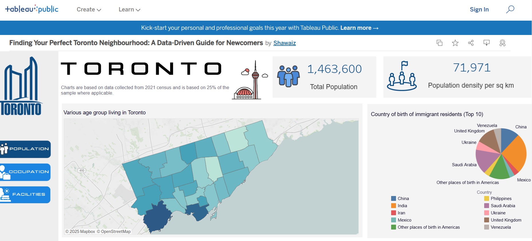
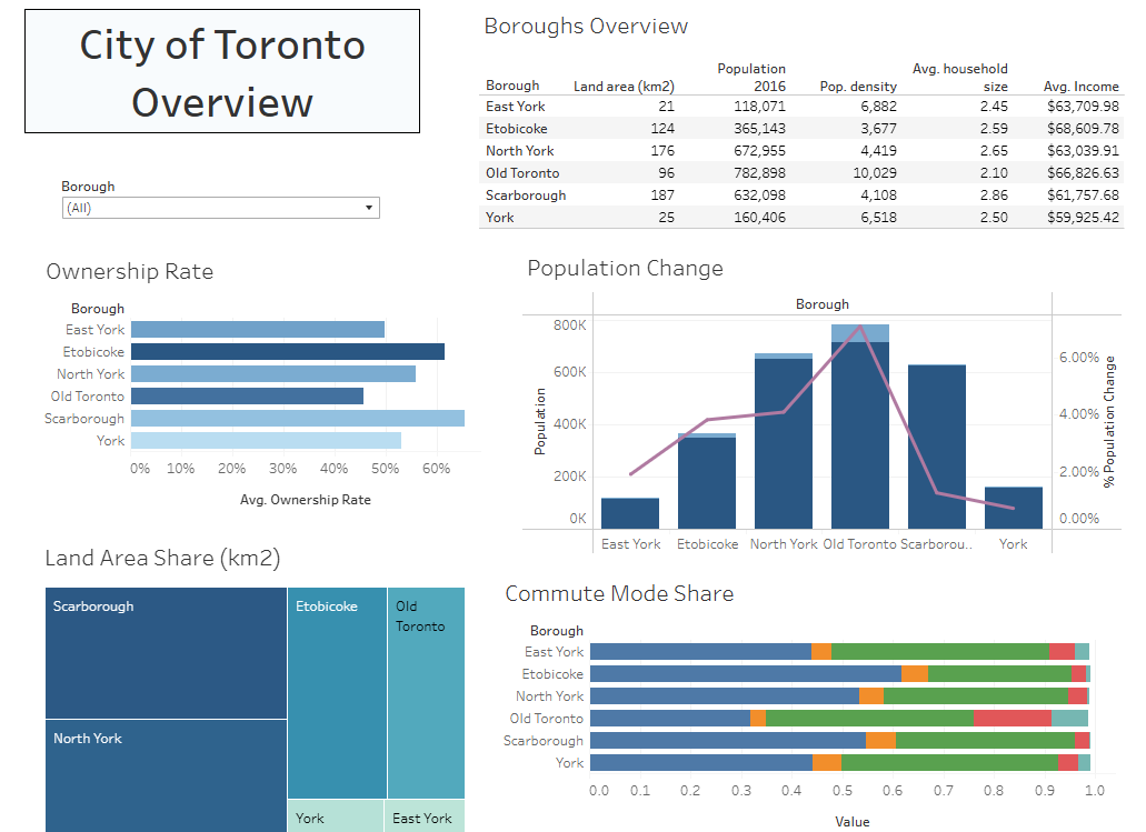
Using Toronto neighbourhood profiles based on 2016 Census Data, exploratory analysis was done with a variety of neighbourhood metrics, such as density, household size, age, and commute modes.
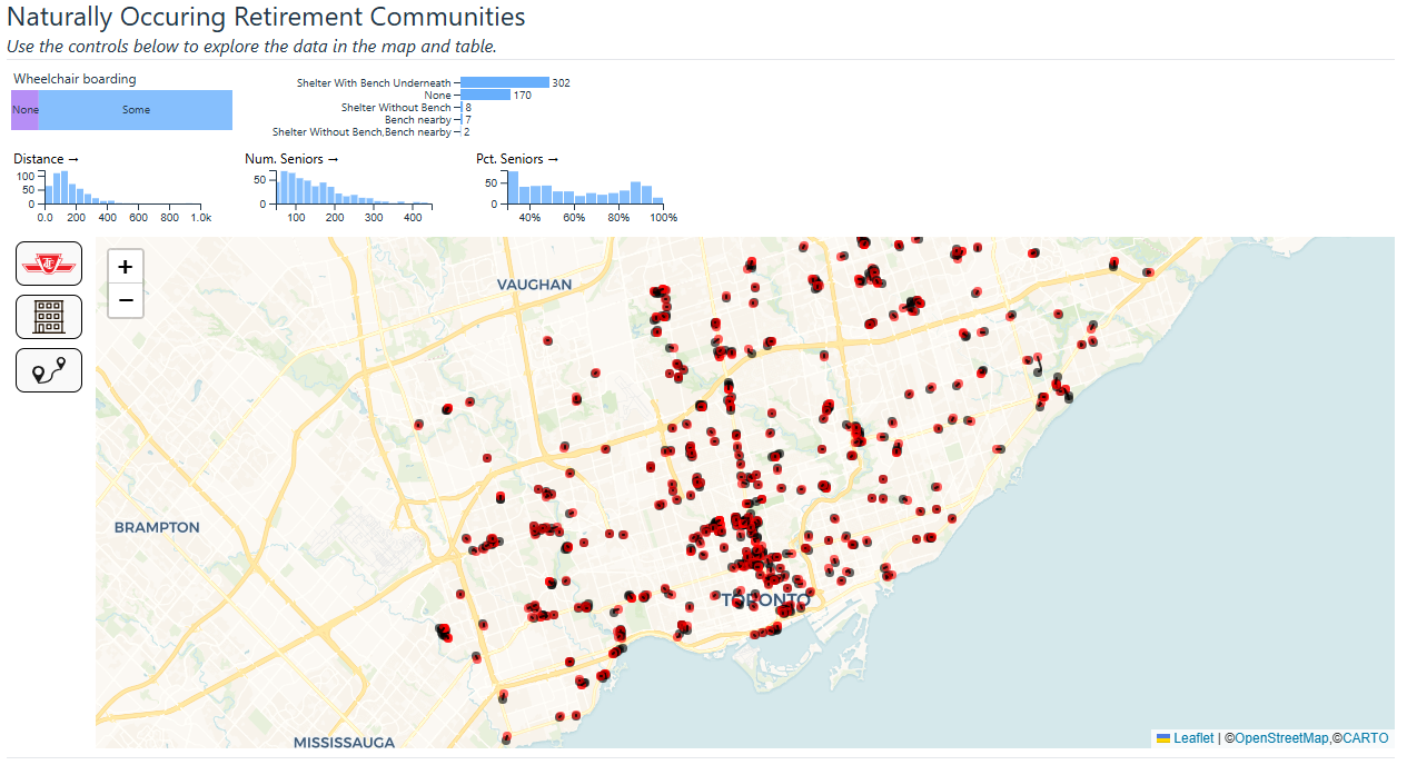
The Naturally Occurring Retirement Communities (NORCs) Access to TTC Stops project addresses the 'Clarity and Impact' criterion by visualizing NORC locations and TTC stop proximity to highlight the accessibility challenges faced by seniors.
By Jeff Allen and Teresa Lau, School of Cities, University of Toronto
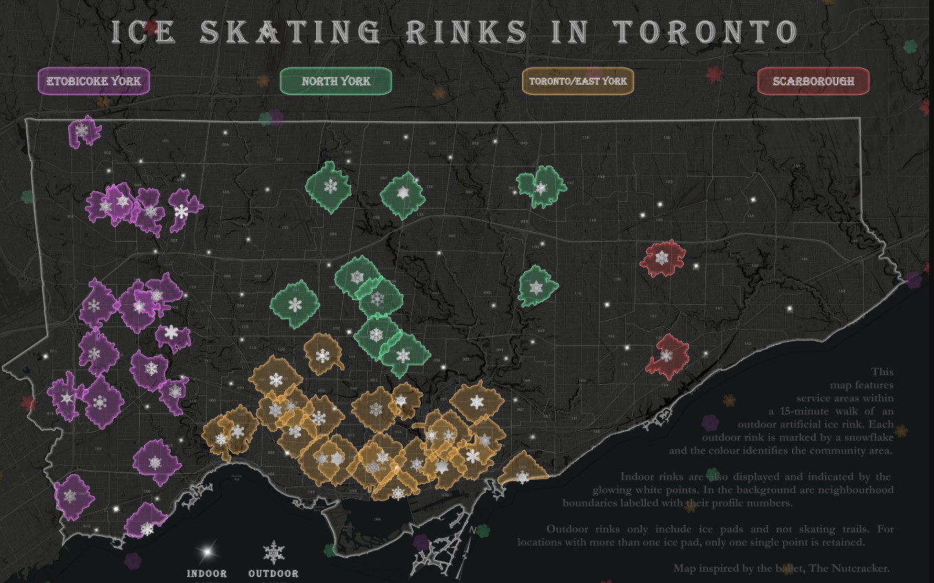
A map showing the locations of outdoor skating rinks in Toronto, with the background of the map coloured by the time it takes to travel to the nearest outdoor skating rink.
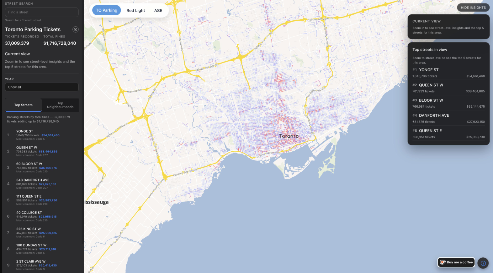
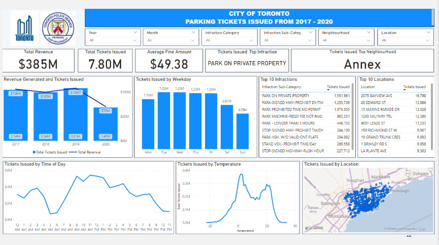
Examined the Toronto parking ticket dataset from 2017-2020 and identified factors that could have impacted trends. Provided fact-based recommendations on what the City of Toronto should do to improve enforcement, compliance or increase revenue.
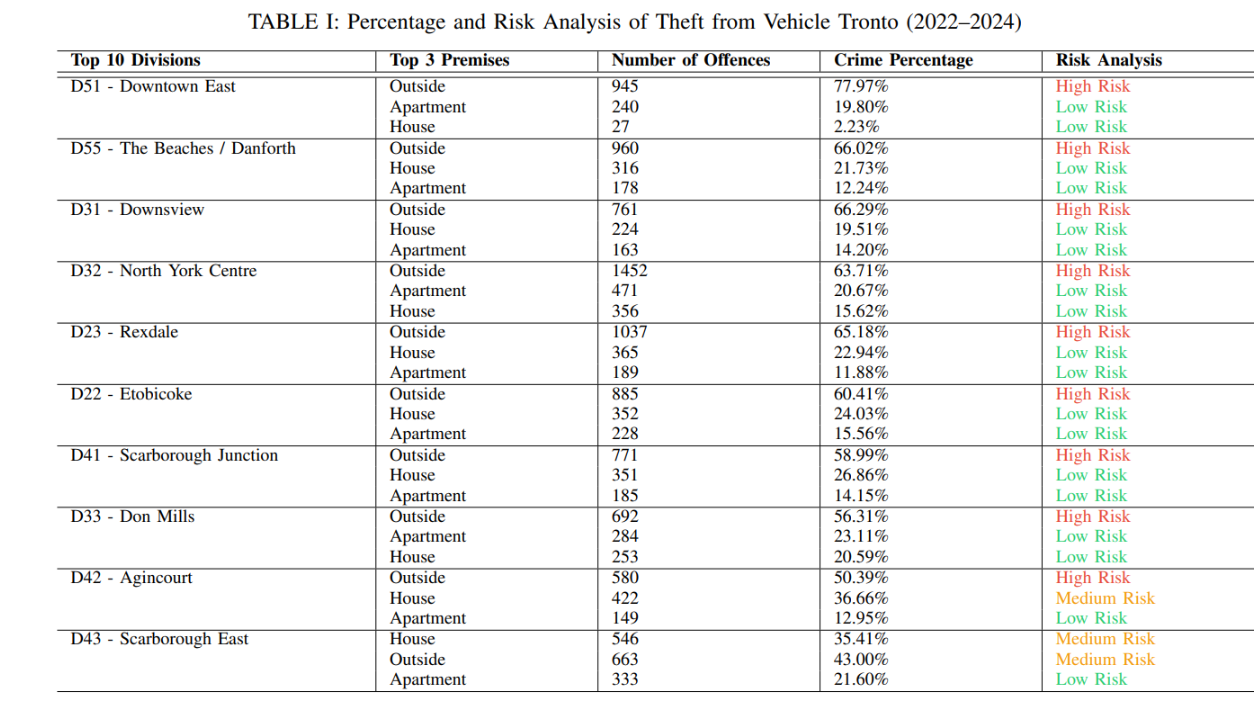
Crime Pattern Detection in Toronto: A Focus on Theft from Motor Vehicles
By Tahmina Akhter
This project analyzes Toronto Police open data on thefts from motor vehicles using statistical and machine learning techniques to identify spatial patterns and risk factors.
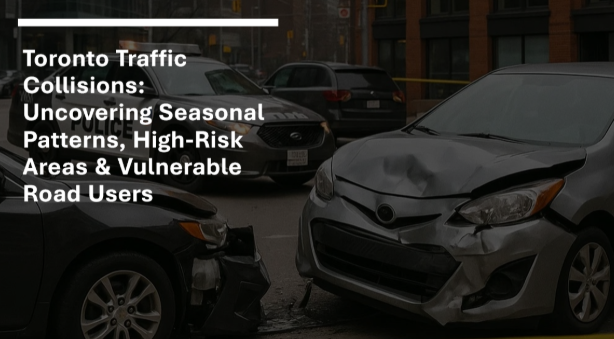
This publication converts 137,000+ collision records into an interactive dashboard, the project helps identify high-risk time periods, locations, and vulnerable road users.
What areas (defined by FSAs) for Toronto have experienced a dramatically increase level of demand on which City of Toronto services (defined by City of Toronto divisions as per 311 Toronto Customer Initiated Service Request Data from m2010-2024 inclusive.
Transit Headway Management Platform for Real-Time Reliability Control
By Interactive-OR Lab
Award Winner
Bus Bunching Correction Pilot: In collaboration with the Toronto Transit Commission (TTC), this headway management pilot on six routes in Toronto to reduce bus bunching (when buses scheduled at even intervals arrive in quick succession) and gapping.
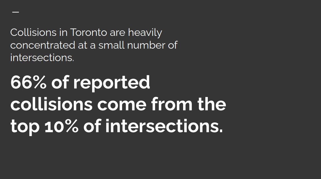
This project analyzes Toronto collision data to identify high-risk intersections that account for a disproportionate share of accidents, making these danger zones visible through an interactive map.
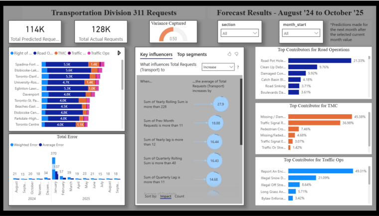
Predicting 311 Requests For Environment and Transport Divisions
By Rahul Lal
Featured Project
This project creates an early-warning and planning system that improves Toronto’s service responsiveness, strengthens resource efficiency, and enhances long-term infrastructure and maintenance planning.
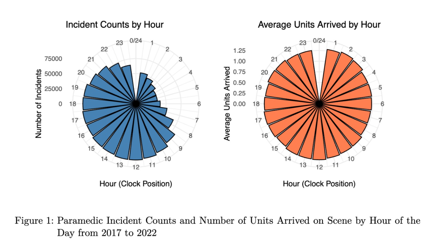
Understanding Paramedic Service Demand and Response
By Denise Chang
By using historical data from 2017 to 2022, the project aims to identify patterns in service demand and how time-based factors such as year, month, day of the week, and hour influence the frequency and nature of incidents.
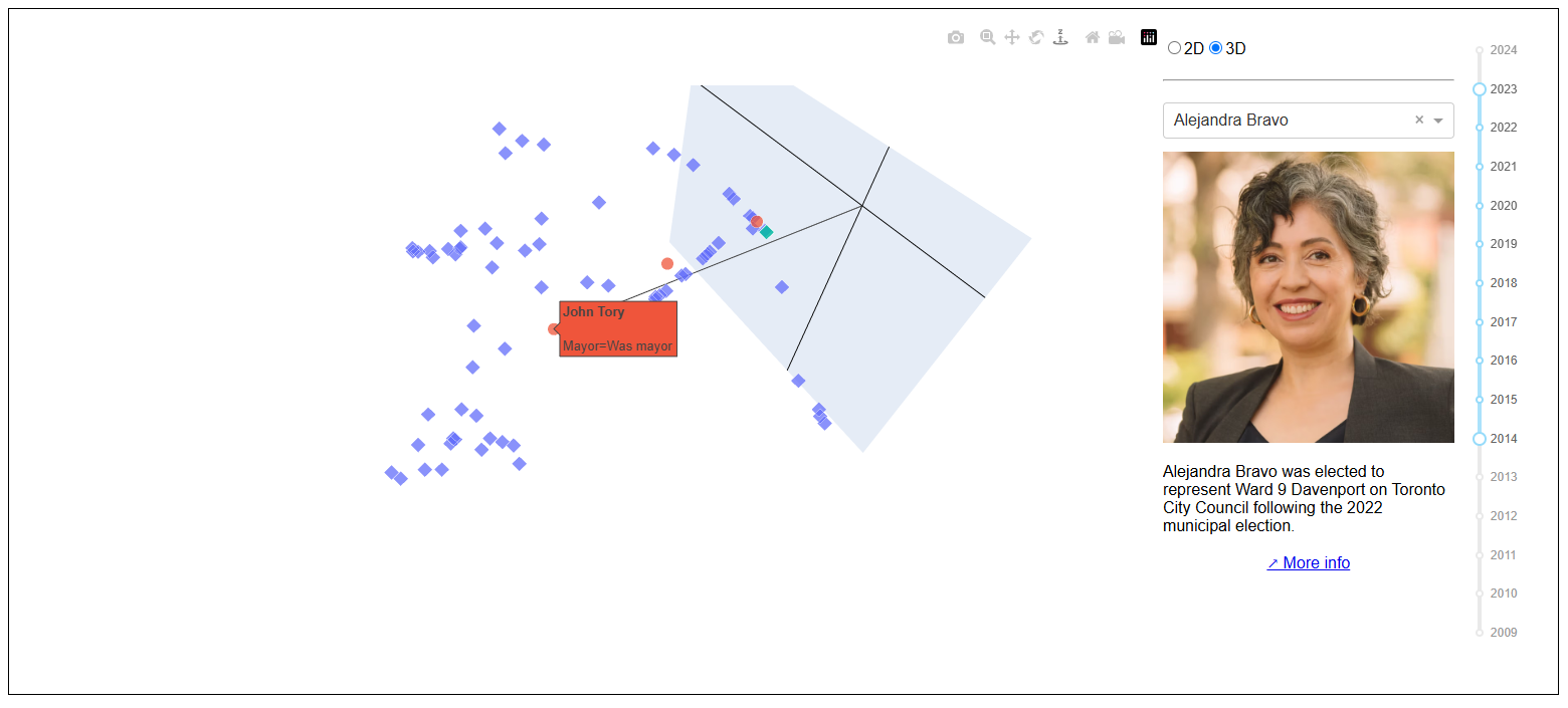
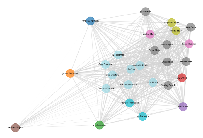
This project analyzed the attendance of city councillors at council meetings, and clustered city councillors based on their voting behaviour into blocs.
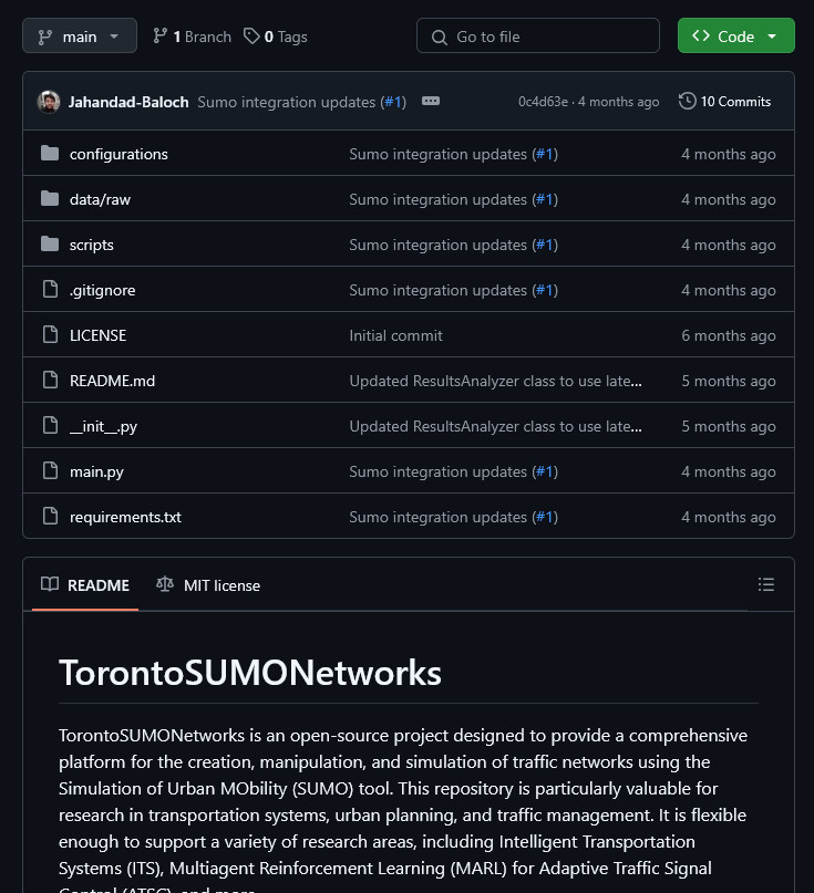
TorontoSUMONetworks is an open-source project designed to simulate and analyze traffic networks for the City of Toronto using the Simulation of Urban MObility (SUMO) tool.
City Hall Watcher is a weekly newsletter exploring the dark corners and nerdy details of Toronto City Hall. Published by award-winning journalist Matt Elliott, its delivered to thousands of people with an interest in knowing how local government works
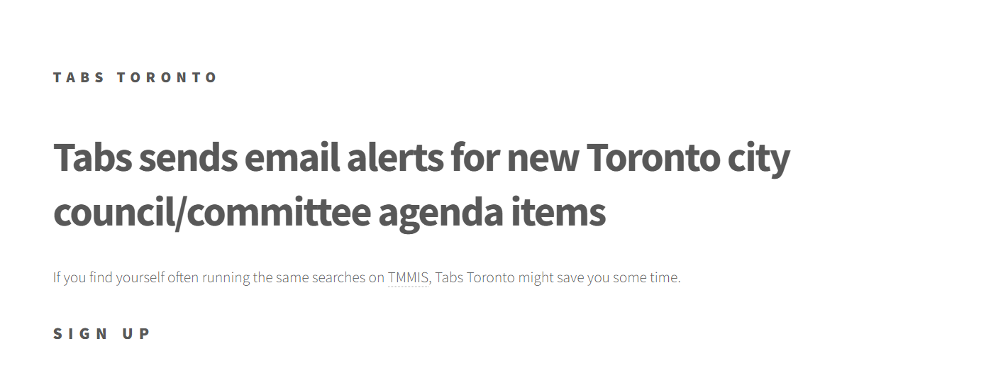
Tabs makes it easy for anyone to find out in advance when a topic they care about will be discussed by city council/committee You give it your email address and terms you care about. Every night it emails you related City of Toronto council or committee items.
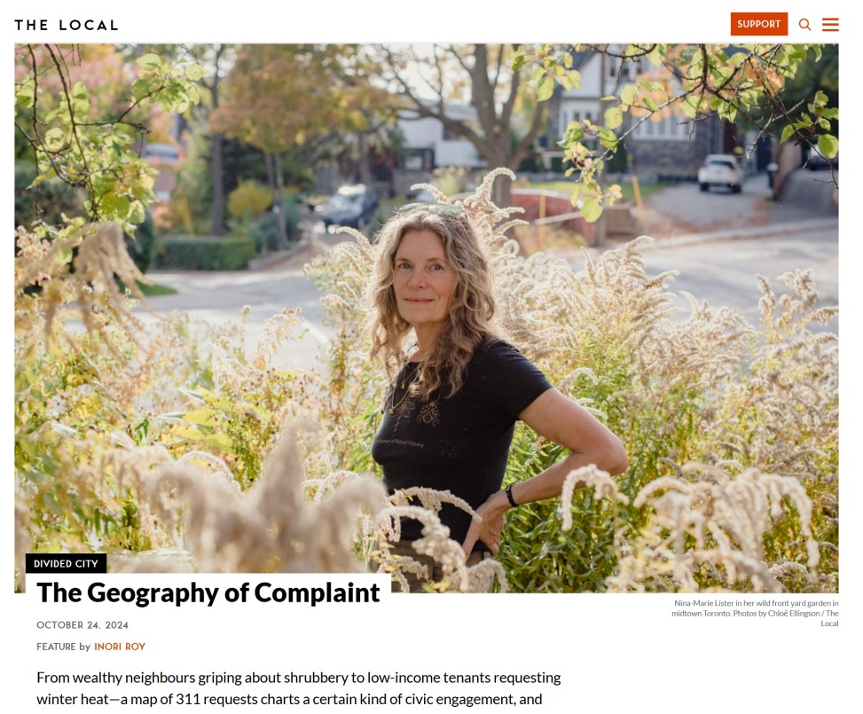
A feature investigating how 311 requests vary by type and frequency across Toronto, and what that might say about civic engagement and privilege in the city.
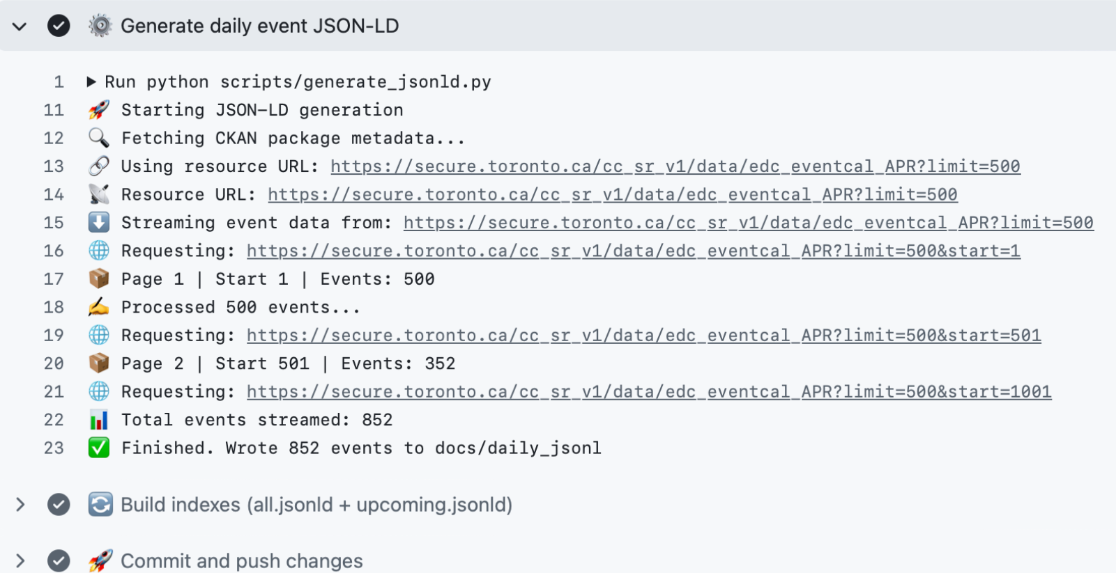
A self-maintaining, GitHub-hosted open data pipeline and static API that transforms Toronto’s festival and event listings into structured Schema.org Event data for reuse in applications, feeds, and search.
This project analyzes Toronto Transit Commission data to identify service issues and uses AI models like ChatGPT and Gemini to generate recommendations for improving transit reliability and user experience.