Blog article: Measuring Walking Times Across Toronto to Nearest TTC Stop
Published on September 12, 2019
Article text
Matthew Tenney (
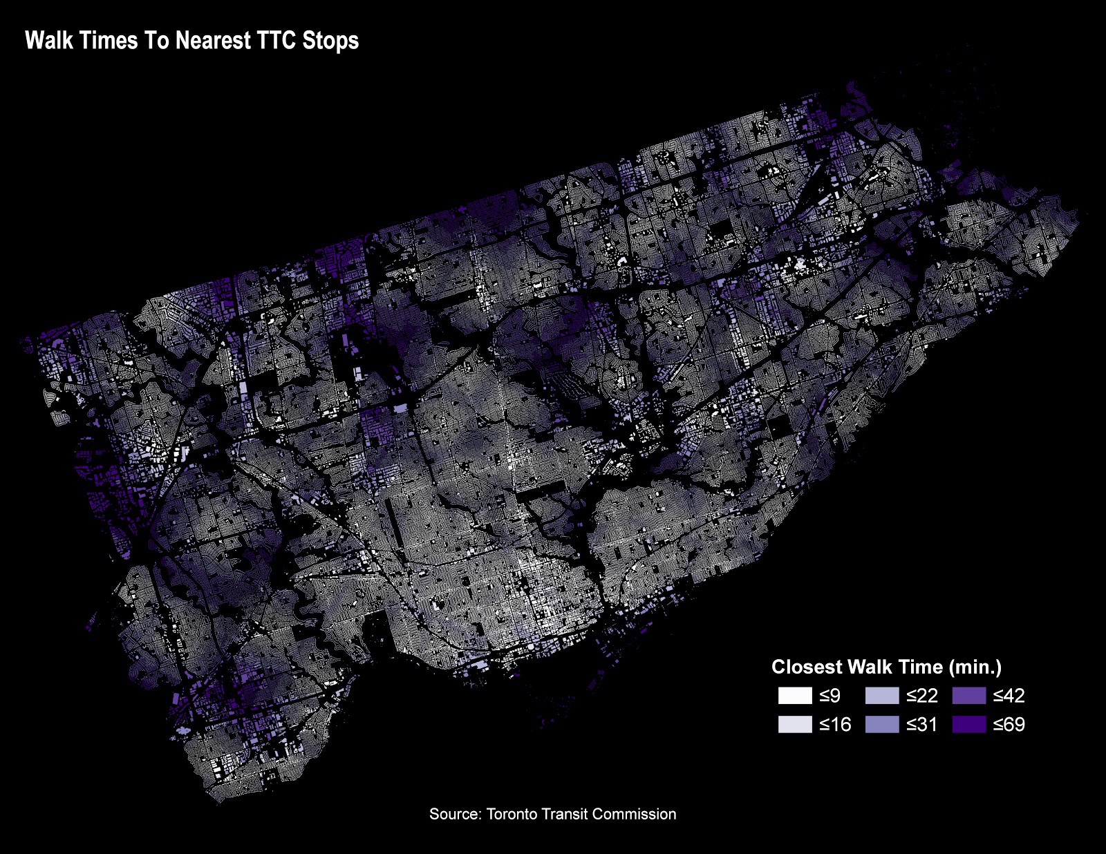
@terra_tenney) is our first guest contributor to Data Stories. In this tutorial, we analyze walk times from every address point within the City of Toronto limits to the closest Toronto Transit Commission (TTC) Stops. TTC stops can include subway, LRT, street car and bus. The analysis uses Pandana to perform the network distance calculations on a new open data set called the “Pedestrian Network” that our team created in conjunction with Transportation Services to better understand walkable access to various amenities across Toronto.
 Read Measuring Walking Times Across Toronto to Nearest TTC Stop Using the Pedestrian Network and Python on Medium.