A list of websites, publications, apps, and more using Toronto Open Data.
By University of Toronto Scarborough, Kalamuna
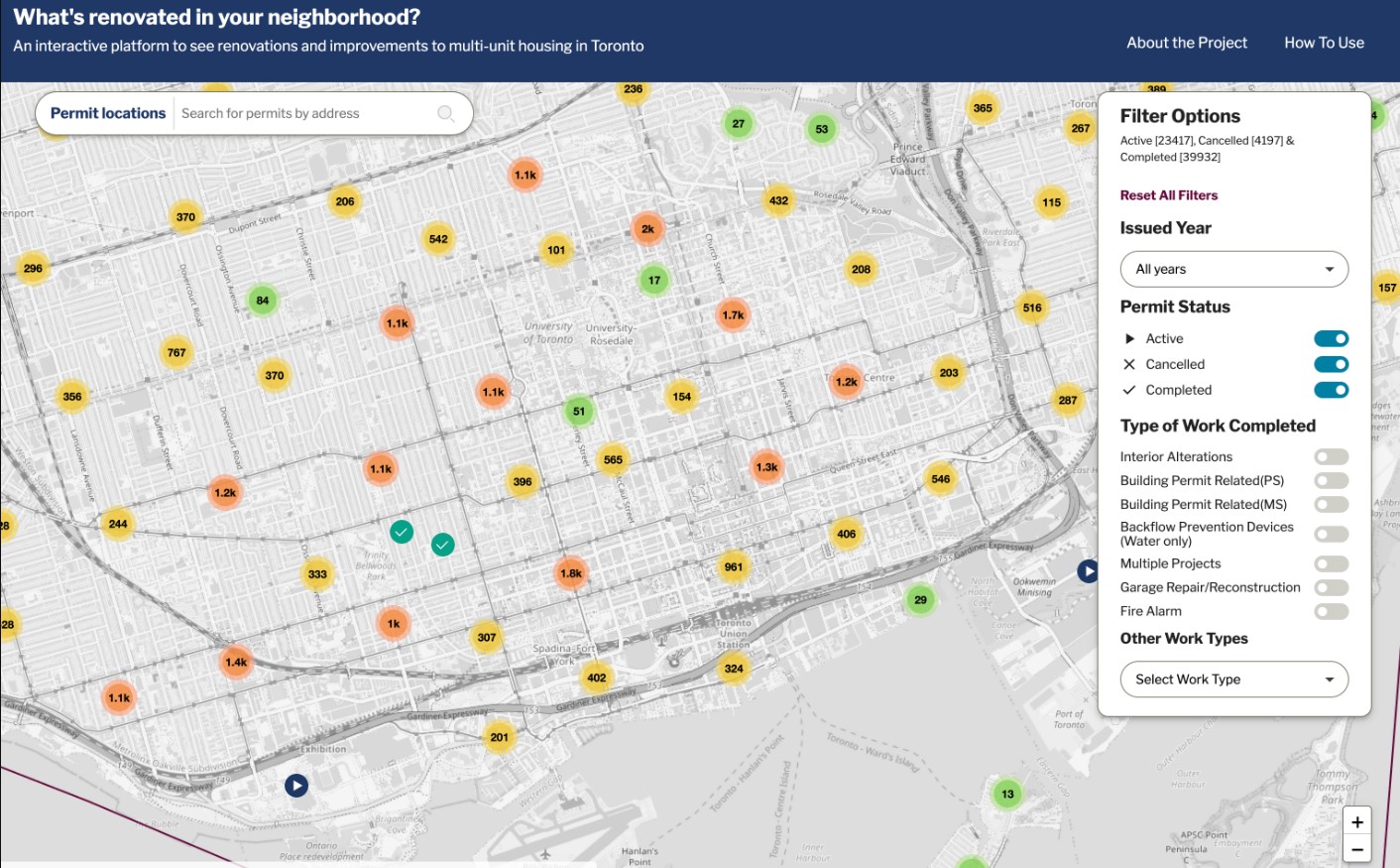
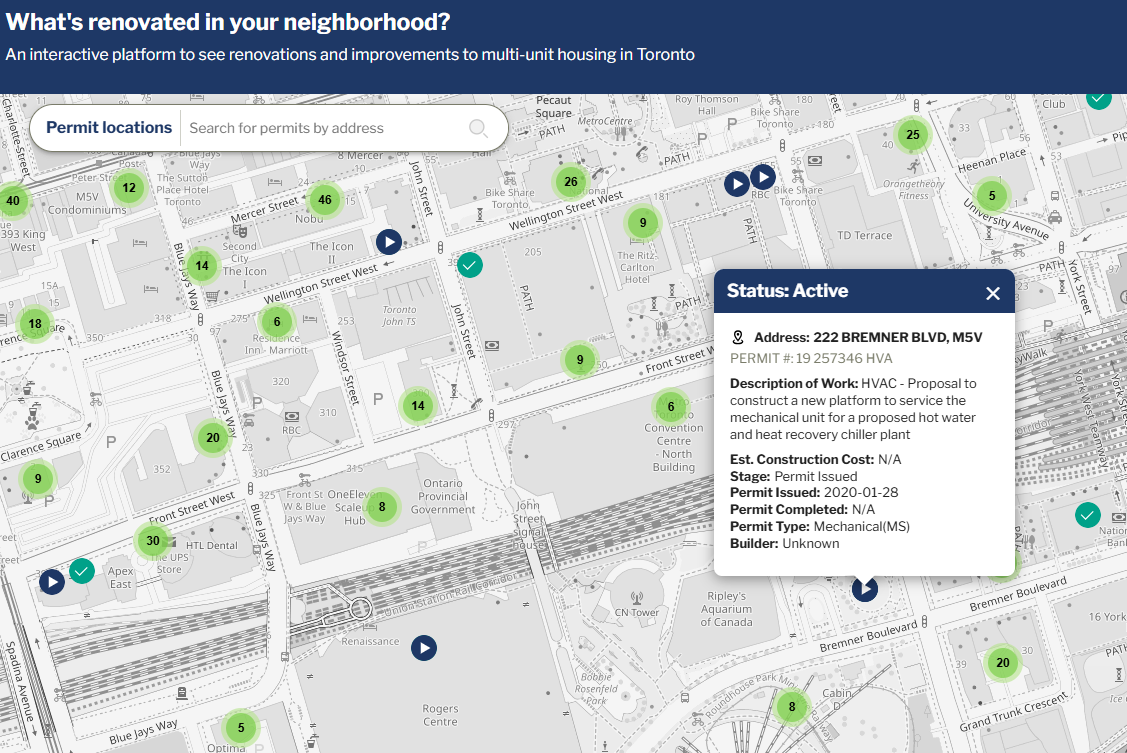
RenovationWatch.ca empowers Toronto renters by transforming complex city building permit data into an accessible, interactive tool to monitor renovations, challenge unjust increases, and advocate against renovictions.
By Mitch Bechtel
Featured ProjectAward Winner
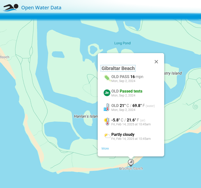
Open Water Data informs open water swimmers and other water recreation users with a wealth of information about popular beaches in Toronto, and around the world so they can make informed decisions about where and when to swim outdoors.
By Mark McCarthy
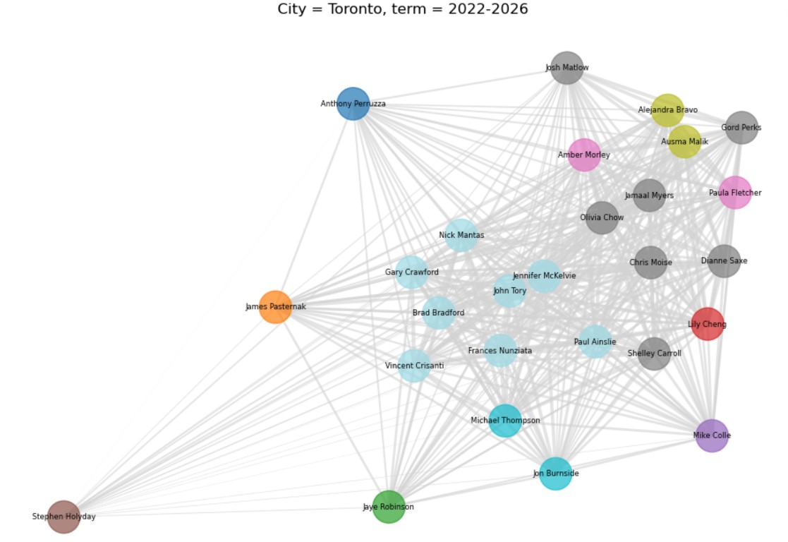
A novel clustering algorithm to find and visualize groups of councillors based their voting records
By Jan Acusta
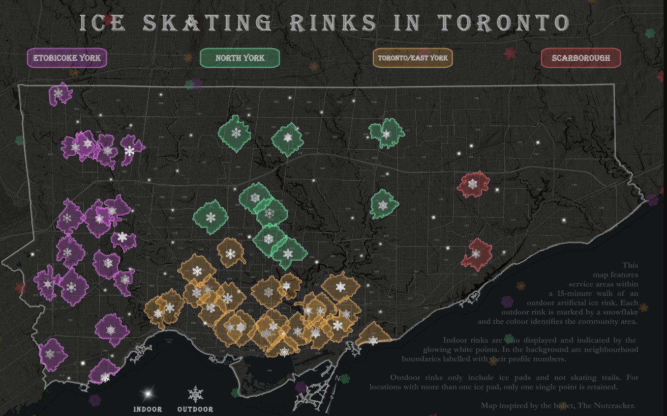
This map features service areas within a 15-minute walk of an outdoor artificial ice rink.
By Jahandad Baloch
Runner Up
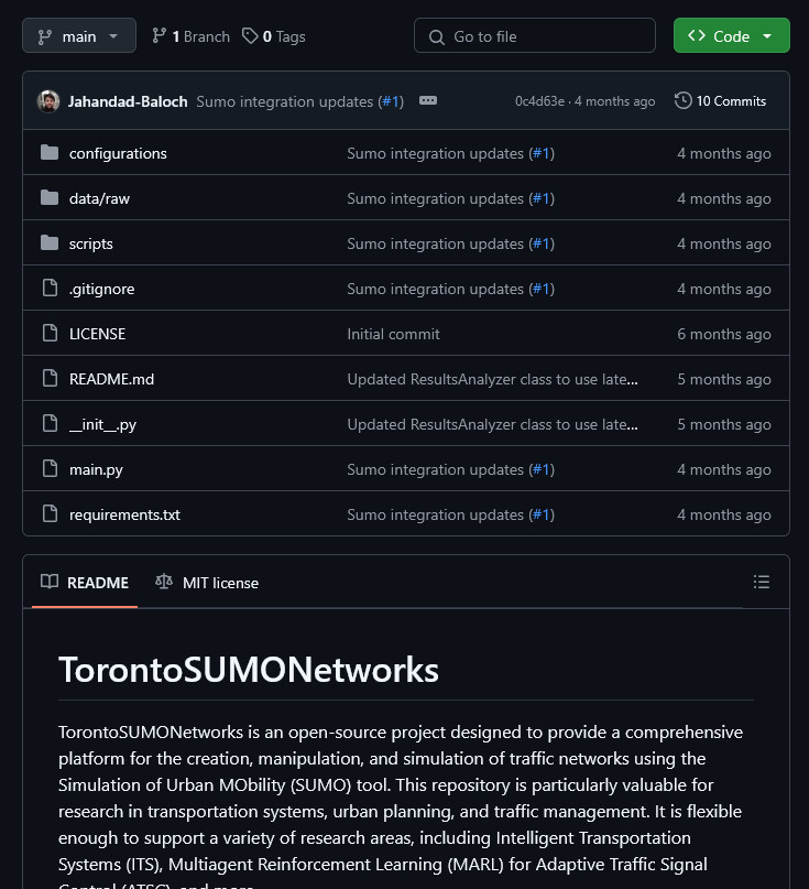
TorontoSUMONetworks is an open-source project designed to simulate and analyze traffic networks for the City of Toronto using the Simulation of Urban MObility (SUMO) tool.
By Cristina Mazza
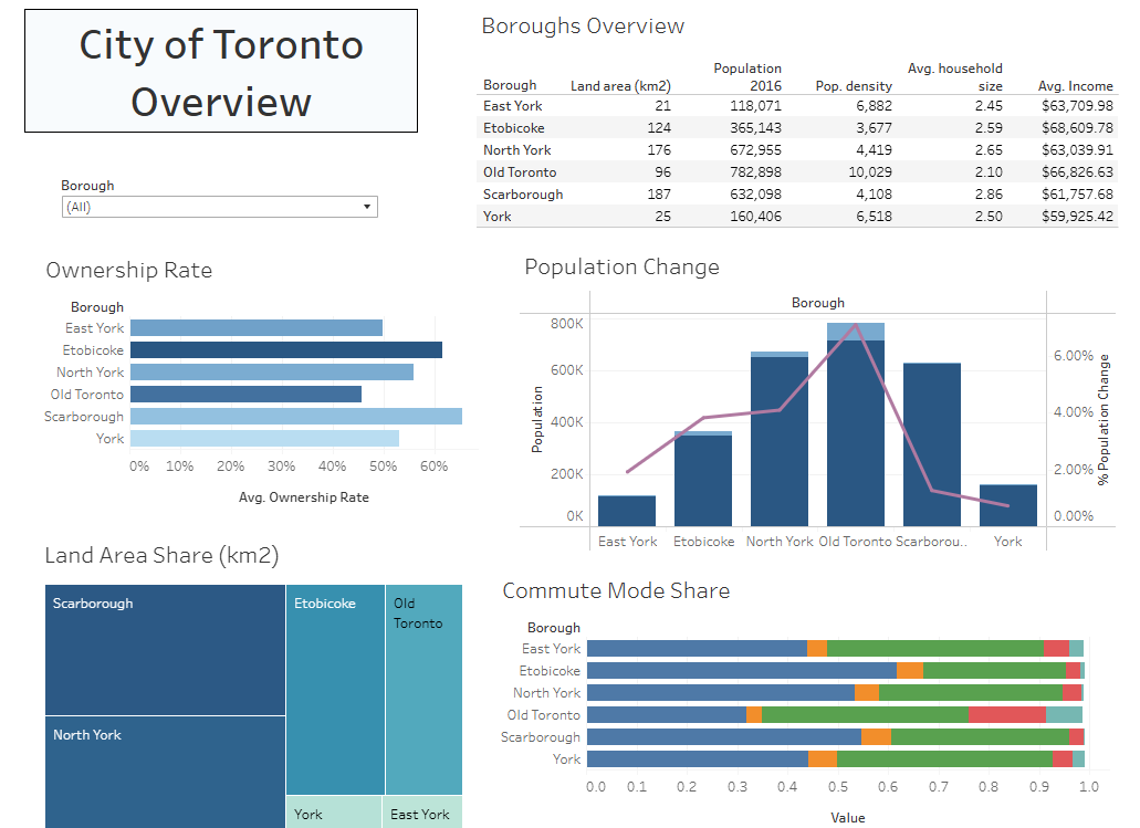
Using Toronto neighbourhood profiles based on 2016 Census Data, exploratory analysis was done with a variety of neighbourhood metrics, such as density, household size, age, and commute modes.
By UHN OpenLab
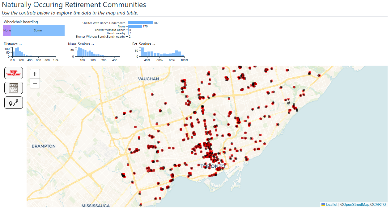
The Naturally Occurring Retirement Communities (NORCs) Access to TTC Stops project addresses the 'Clarity and Impact' criterion by visualizing NORC locations and TTC stop proximity to highlight the accessibility challenges faced by seniors.
By University of Toronto Scarborough
RenovationWatch.ca addresses the housing insecurity crisis in Toronto by making city building permit data for multi-unit rental housing accessible.
By Malini Sinha
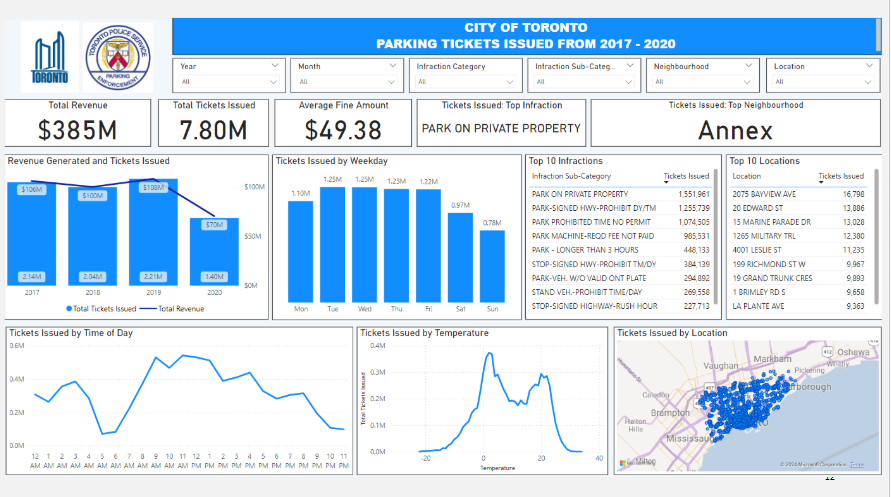
Examined the Toronto parking ticket dataset from 2017-2020 and identified factors that could have impacted trends. Provided fact-based recommendations on what the City of Toronto should do to improve enforcement, compliance or increase revenue.
By Jeff Allen and Teresa Lau, School of Cities, University of Toronto
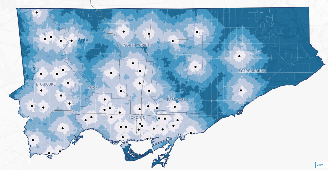
A map showing the locations of outdoor skating rinks in Toronto, with the background of the map coloured by the time it takes to travel to the nearest outdoor skating rink.
By Jeff Allen, School of Cities, University of Toronto
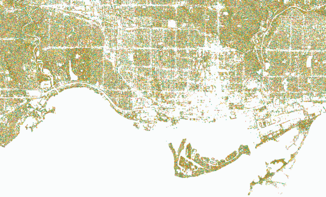
A data-dense visualization of all the trees in Toronto to allow people to easily view and compare spatial distribution of tree cover across different scales
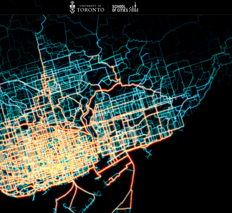
A map visualizing all Bike Share trips in June of 2024 to highlight where people cycle across the city. Project goals were initially descriptive and exploratory, but the map has since been used to advocate for more (not less) cycling infrastructure in Toronto